
Existed: 1934 – present Length 112.7 km | Constructed 1934 | |
 | ||
South end: SR 113 at Knights Landing | ||
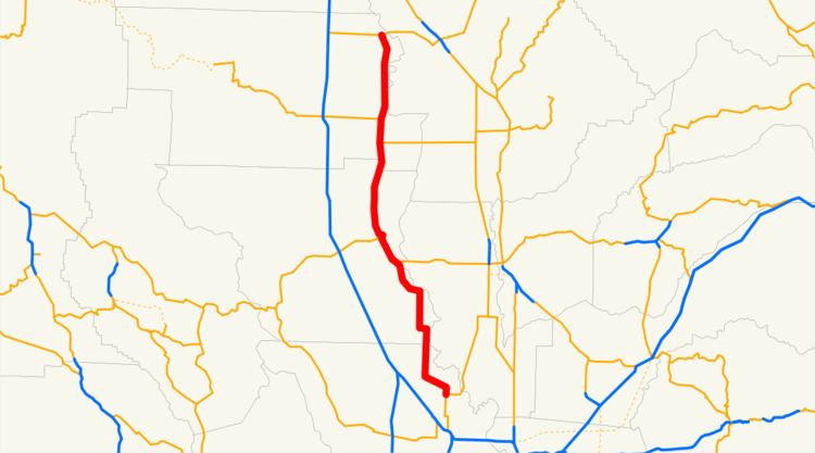
State Route 45 (SR 45) is a state highway in the U.S. State of California that travels in a north–south direction from Route 113 in Knights Landing to Route 32 in Hamilton City.
Contents
Map of CA-45, California, USA
Route description
This route is part of the California Freeway and Expressway System.
The route begins at SR 113 in Knights Landing in Yolo County. It then heads northward and enters Colusa County, where it has a short overlap with SR 20. It then enters Glenn County, where it overlaps SR 162 through the cities of Codora and Glenn. It the continues northward to its end at SR 32 in Hamilton City.
Major intersections
Except where prefixed with a letter, postmiles were measured on the road as it was in 1964, based on the alignment that existed at the time, and do not necessarily reflect current mileage. R reflects a realignment in the route since then, M indicates a second realignment, L refers an overlap due to a correction or change, and T indicates postmiles classified as temporary (for a full list of prefixes, see the list of postmile definitions). Segments that remain unconstructed or have been relinquished to local control may be omitted. The numbers reset at county lines; the start and end postmiles in each county are given in the county column.