
Length 48.28 km | ||
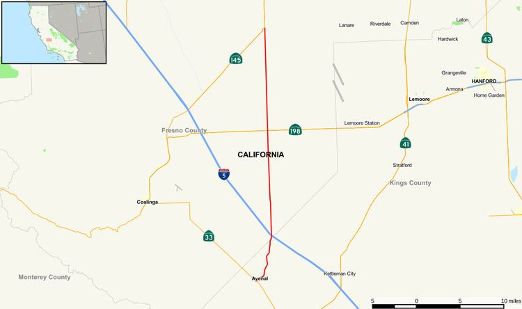 | ||
State Route 269 is a state highway in California, United States, which runs from Avenal to State Route 145.
Contents
Map of CA-269, California, USA
Route description
The southern terminus of SR 269 is at State Route 33 in Avenal, where it drops into the San Joaquin Valley at I-5. In the city of Avenal, it is known as Skyline Boulevard. From the Fresno-Kings county line, right before I-5 to its northern terminus at SR 145, the road is known as Lassen Avenue and heads due north through Huron.
History
In 1959, Legislative Route number 269 was defined as "from LRN 61 to LRN 23 south of Palmdale." Today, this route is Angeles Forest Highway and Los Angeles County Route N3. The route was defined as a California State route in 1972 as "SR 33 at Avenal to SR 145 near Five Points.”
Major intersections
Except where prefixed with a letter, postmiles were measured on the road as it was when the route was established, based on the alignment that existed at the time, and do not necessarily reflect current mileage. R reflects a realignment in the route since then, M indicates a second realignment, L refers an overlap due to a correction or change, and T indicates postmiles classified as temporary (for a full list of prefixes, see the list of postmile definitions). Segments that remain unconstructed or have been relinquished to local control may be omitted. The numbers reset at county lines; the start and end postmiles in each county are given in the county column.