
Existed: July 1, 1964 – present Length 23.16 km | South end: I-680 in Fremont Constructed 1 July 1964 | |
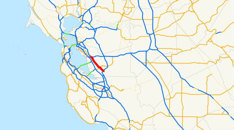 | ||
North end: I-238 / I-580 in Castro Valley | ||
State Route 238 (SR 238) is a north–south highway in the U.S. state of California. The route is a divided multilane surface highway in the southeastern part of the San Francisco Bay Area. SR 238 connects Interstate 580 in Castro Valley and Interstate 680 in Fremont.
Contents
Route description
SR 238 goes through Hayward and Union City parallel to the Hayward hills. It formerly contained a segment of east–west freeway now designated as Interstate 238 and, until Interstate 680 was completed in the area and supplanted it completely as a through route, extended to San Jose, California at its intersection with U.S. Route 101. Locally it is designated Mission Boulevard from I-680 to the intersection with State Route 92 and State Route 185 (which continues as Mission Boulevard). It is designated as Foothill Boulevard in northern Hayward from A Street to I-580.
In Downtown Hayward immediately north of SR 92, northbound traffic continues along the original SR 238 alignment on Foothill Boulevard, while southbound traffic is diverted onto A Street and Mission Boulevard. This loop of one-way streets is known as the "Hayward Loop".
Mission Boulevard
Mission Boulevard, the former El Camino Viejo and El Camino Real, is the road that passes in front of Mission San José, the historic Spanish Mission founded in 1797, for which the road is named. Mission Boulevard proceeds in both directions from the Mission, but mainly northwest (the former El Camino Viejo) through Fremont, Union City, and Hayward. At the north end of Hayward it changes its name to East 14th Street, which continues as a major thoroughfare going through San Leandro and Oakland. Since it runs along the base of the hills, Mission Boulevard nearly coincides with the Hayward Fault, a major earthquake fault, for almost the entire length of the Boulevard. The southern direction from the Mission San José is the former El Camino Real route to Mission Santa Clara de Asís.
Mission Boulevard joins the historic centers of the Mission San Jose and Niles districts of Fremont (formerly independent towns), the Decoto district of Union City (formerly an independent town), and Hayward.
History
Before California massively renumbered its state highways in 1964, SR 238 was part of State Route 9. The segment of what is now Interstate 238 was built as a freeway in 1956, before it became part of the Interstate Highway System in 1983.
For several decades, SR 238 from Hayward to Fremont was also planned to be upgraded to a freeway, called the "Mission" or "Foothill" freeway. It was submitted to the Interstate Highway System in October 1968 but was rejected. Then after a series of lawsuits and appeals, Caltrans had to abandon the project in 2004 and sell off the property it had acquired in the name of eminent domain along the proposed route.
As an alternative, SR 238 is proposed to be expanded from two lanes in each direction to three lanes in each direction along the majority of its width. Various other improvements began in July 2010, followed by the California legislature relinquishing control of SR 238 within Hayward to local control in 2012. In March 2013, the routing in Downtown Hayward was changed to include a one way circulation known as the "Hayward Loop", designed to improve traffic flow between SR 238, SR 185 and SR 92.
Major intersections
Except where prefixed with a letter, postmiles were measured on the road as it was in 1964, based on the alignment that existed at the time, and do not necessarily reflect current mileage. R reflects a realignment in the route since then, M indicates a second realignment, L refers an overlap due to a correction or change, and T indicates postmiles classified as temporary (for a full list of prefixes, see the list of postmile definitions). Segments that remain unconstructed or have been relinquished to local control may be omitted. The entire route is in Alameda County.