
Length 6.61 km | ||
 | ||
County | ||
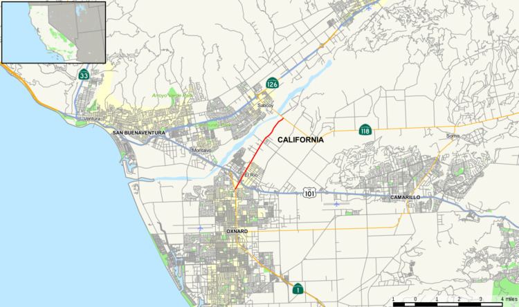
State Route 232 (SR 232) is a state highway in Ventura County, California. It serves as a connector between US 101, and SR 118.
Contents
Map of CA-232, Oxnard, CA 93036, USA
Route description
SR 232 is part of the California Freeway and Expressway System. It starts on Vineyard Avenue at the U.S. Route 101 interchange near the Martinez Shopping Center, and runs through El Rio. SR 232 leaves the Oxnard city limits and ends at Los Angeles Avenue (Route 118).
History
At the 1932 Summer Olympics near Los Angeles, it hosted part of the road cycling event when it was Vineyard Avenue. Route 154 was defined in 1933 from El Rio to Saticoy; the route was renumbered as SR 232 in the 1964 state highway renumbering. By 2014, the route was redefined to start at US 101, eliminating the part in Oxnard that had been relinquished.
Future
According to the 2003 Caltrans District 7 Master System Plan Status Map, California Route 232 will be realigned from Vineyard Avenue to Santa Clara Avenue.
Major intersections
Except where prefixed with a letter, postmiles were measured on the road as it was in 1964, based on the alignment that existed at the time, and do not necessarily reflect current mileage. R reflects a realignment in the route since then, M indicates a second realignment, L refers an overlap due to a correction or change, and T indicates postmiles classified as temporary (for a full list of prefixes, see the list of postmile definitions). Segments that remain unconstructed or have been relinquished to local control may be omitted. The entire route is in Ventura County.