
Existed: 1972 – present Counties: San Diego Constructed 1972 | Length 2.98 km | |
 | ||
County | ||
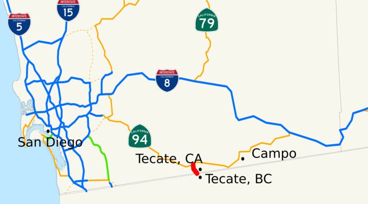
State Route 188 (SR 188) is a two-mile (3 km) route that connects State Route 94 with the Mexico – United States border. Its southern terminus is at the border near Tecate, Baja California and its northern terminus is near Tecate, California with SR 94. The route was assigned in the area in 1972, and has remained intact since.
Contents
Map of CA-188, Tecate, CA 91980, USA
Route description
State Route 188 or Tecate Road begins at the U.S.-Mexico border in the community of Tecate, Baja California; this border crossing handled roughly four percent of all traffic in between Baja California and California during 2008. The route progresses northward, passing through a large commercial district in Tecate, California. The highway heads to an intersection with Thing Road, where it turns to the northeast and out of the commercial district. The route continues to the northeast, intersecting with Humphries Road, where the surroundings become highly undeveloped. SR 188 continues to an intersection with SR 94 a short distance out of Potrero, where the designation ends and right-of-way merges into SR 94.
The entire route is in the National Highway System, a network of roadways important to the country's economy, defense, and mobility. In 2013, SR 188 had an annual average daily traffic (AADT) of 5,600 at the northern terminus, and 5,900 at the southern terminus, the latter of which was the highest AADT for the highway.
History
The original alignment of SR 188, when routes where first assigned, was designated as Legislative Route 94. In the 1964 state highway renumbering, SR 188 was officially defined as "the south end of Fallen Leaf Lake to Route 89 near Camp Richardson"; this was later removed in 1965.
A road from the town of Potrero to Tecate existed by 1917. The Tecate border crossing originally opened in 1932. In 1938, the San Diego County board of supervisors proposed moving rerouting the road to be shorter and on more level ground, although there was opposition from local residents and businesses who favored the old road. However, the route of the road to Tecate has remained the same since then.
The current routing of SR 188 was assigned in 1972. The route has remained virtually unchanged since. The Tecate border crossing expanded through the opening of the Tecate Commercial Vehicle Enforcement Facility, including truck scales; this was completed in 2008, with past expansions to the crossing having been completed in 2004 and 2005.
Future
Improvements are being planned to connect the two ports of entry with a truck bypass to improve security; these are scheduled for completion by 2015.
Major intersections
The entire route is in San Diego County.