
Length 14.35 km | Counties: Tehama | |
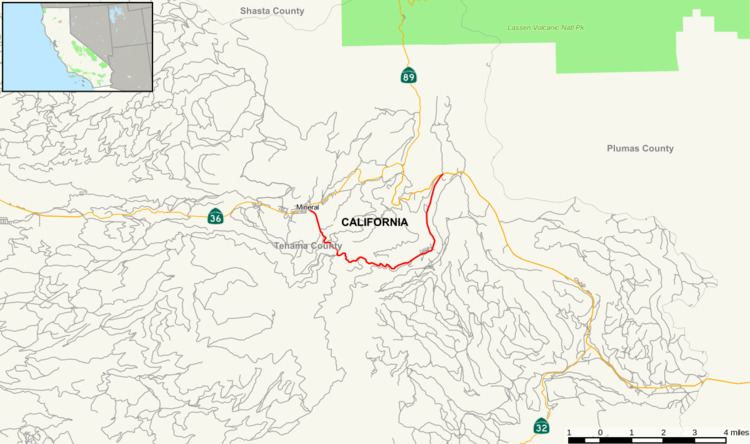 | ||
East end: SR 36 / SR 89 at Morgan Springs | ||
State Route 172 (SR 172) is a state highway in the U.S. state of California in Tehama County. It is a loop route off of State Route 36.
Contents
Map of CA-172, Mineral, CA, USA
Route description
SR 172 begins at a junction with SR 36 and heads southeast through Lassen National Forest. The route then turns south, crossing the South Fork Battle Creek and entering a wooded area. The road then winds eastward through the forest, roughly parallel to Mill Creek. SR 172 then turns northward along Mill Creek and heads back toward SR 36, its eastern terminus.
Major intersections
Except where prefixed with a letter, postmiles were measured on the road as it was in 1964, based on the alignment that existed at the time, and do not necessarily reflect current mileage. R reflects a realignment in the route since then, M indicates a second realignment, L refers an overlap due to a correction or change, and T indicates postmiles classified as temporary (for a full list of prefixes, see the list of postmile definitions). Segments that remain unconstructed or have been relinquished to local control may be omitted. The entire route is in Tehama County.