
Counties: Shasta | Length 11.27 km | |
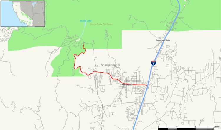 | ||
State Route 151 (SR 151) is a state highway in the U.S. state of California. The route runs from Shasta Dam to Interstate 5 near Shasta Lake City, California. Its routing is in Shasta County, California.
Contents
Map of CA-151, Shasta Lake, CA 96019, USA
This route is eligible for the State Scenic Highway System.
Route description
SR 151 begins at Shasta Dam, where the Sacramento River is dammed to form Shasta Lake. From Shasta Dam, the road heads south as Shasta Dam Boulevard, crossing through heavily vegetated area. The road then meets CR A18 within the city of Shasta Lake. Heading eastward, the road enters the center of Shasta Lake before meeting its eastern terminus at Interstate 5.
Major intersections
Except where prefixed with a letter, postmiles were measured on the road as it was in 1964, based on the alignment that existed at the time, and do not necessarily reflect current mileage. R reflects a realignment in the route since then, M indicates a second realignment, L refers an overlap due to a correction or change, and T indicates postmiles classified as temporary (for a full list of prefixes, see the list of postmile definitions). Segments that remain unconstructed or have been relinquished to local control may be omitted. The entire route is in Shasta County.