
Area 1,487 km² Population 14,682 (2013) Unemployment rate 6.0% (Apr 2015) | Founded 26 January 1838 | |
 | ||
Website www.calhouncountyfl.org Rivers Apalachicola River, Chipola River, Juniper Creek | ||
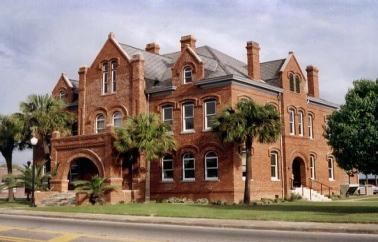
Calhoun County is a county located in the U.S. state of Florida. As of the 2010 census, the population was 14,625, making it the fifth-least populous county in Florida. Its county seat is Blountstown.
Contents
- Map of Calhoun County FL USA
- History
- Geography
- Adjacent counties
- Demographics
- Major Roads
- Airport
- Voter Registration
- Statewide Elections
- Library
- City
- Town
- References
Map of Calhoun County, FL, USA
History
Calhoun County was created in 1838. It was named for John C. Calhoun, member of the United States Senate from South Carolina and the seventh U.S. vice president, serving under John Quincy Adams and Andrew Jackson. Typical in the Florida Panhandle, a majority of Calhoun County's residents remain much more attached to Southern culture and lifestyle habits than is common in the Central and Southern regions of the state, and the area holds much more in common with states such as Alabama, Georgia, or Mississippi than with much of Florida.
In 1930 a "federal agent" shot the County Sheriff.
Geography
According to the U.S. Census Bureau, the county has a total area of 574 square miles (1,490 km2), of which 567 square miles (1,470 km2) is land and 7.0 square miles (18 km2) (1.2%) is water. The county is bounded on the east by the Apalachicola River and is bisected by the Chipola River, site of Look and Tremble.
Adjacent counties
Demographics
As of the census of 2000, there were 13,017 people, 4,468 households, and 3,132 families residing in the county. The population density was 23 people per square mile (9/km²). There were 5,250 housing units at an average density of 9 per square mile (4/km²). The racial makeup of the county was 79.87% White, 15.79% Black or African American, 1.26% Native American, 0.53% Asian, 0.05% Pacific Islander, 1.04% from other races, and 1.45% from two or more races. 3.78% of the population were Hispanic or Latino of any race.
There were 4,468 households out of which 32.50% had children under the age of 18 living with them, 52.30% were married couples living together, 13.50% had a female householder with no husband present, and 29.90% were non-families. 26.50% of all households were made up of individuals and 12.40% had someone living alone who was 65 years of age or older. The average household size was 2.53 and the average family size was 3.02.
In the county, the population was spread out with 23.20% under the age of 18, 9.00% from 18 to 24, 31.50% from 25 to 44, 22.30% from 45 to 64, and 14.00% who were 65 years of age or older. The median age was 36 years. For every 100 females there were 117.20 males. For every 100 females age 18 and over, there were 120.80 males.
The median income for a household in the county was $26,575, and the median income for a family was $32,848. Males had a median income of $26,681 versus $21,176 for females. The per capita income for the county was $12,379. About 14.80% of families and 20.00% of the population were below the poverty line, including 23.60% of those under age 18 and 20.40% of those age 65 or over.
Major Roads
Calhoun County has no Interstate or U.S. Highways, but does contain some important state roads.
Airport
Voter Registration
According to the Secretary of State's office, Democrats maintain a massive majority among registered voters in Calhoun County.
Statewide Elections
Like most of the Florida Panhandle, Calhoun County votes heavily Republican in presidential and congressional races yet still occasionally supports conservative Democrats in local and state contests.
Library
Along with the 6 branches within the Calhoun County Public Library System, Calhoun County is also a part of the Panhandle Public Library Cooperative System. The PPLC also includes Holmes, Jackson, and Washington counties.