
Population 36 (2002) | Local time Monday 9:43 AM | |
 | ||
Area code(s) Country + town = 56 + 43 Weather 9°C, Wind SE at 3 km/h, 85% Humidity | ||
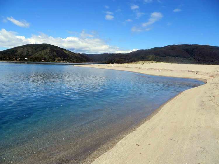
Caleta Chaihuín (Chaihuín) is a coastal hamlet (Spanish: caserío) and rural district in the commune of Corral, Los Ríos Region, Chile. It lies at the mouth of Chaihuín River that flows from the Valdivian Coast Range to the Pacific Ocean. Silt from the river combined with the prevailing coastal current have formed a barrier-bar across the cove creating an estuary. The administration and main entrance to the Valdivian Coastal Reserve lies in Chaihuín.
Contents
Map of Caleta Chaihu%C3%ADn, Corral, Los R%C3%ADos Region, Chile
History
The indigenous inhabitants of the area are Huilliche people.
During the early 1970s Chaihuín was considered a hot-bed of the Revolutionary Left Movement (MIR), but with limited actual anti-government activity.
In 2010 a new ferry service from the town of Corral was inaugurated.
Demographics
The rural district of Chaihuín encompasses a larger area than the hamlet itself. Its population has grown from 206 in 1920 to over 800.