
Surface elevation 194 m | Primary inflows Catchment area 764 km² | |
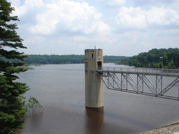 | ||
Cagles mill lake and lieber sra indiana dnr
Cagles Mill Lake, also known as Cataract Lake, is a reservoir located near Cataract, Indiana in Lieber State Recreation Area, in west central Indiana on the borders of Putnam and Owen counties. Mill Creek flows into from the north and drains out through to the Eel River to its south, which then makes its way to the White River. Indiana State Road 42 once went through where Cataract Lake is now and currently has a new, entirely different route on the upper area from its original route.
Contents
- Cagles mill lake and lieber sra indiana dnr
- Map of Cagles Mill Lake Indiana USA
- Cagles mill lake tailwater fishing
- References
Map of Cagles Mill Lake, Indiana, USA
Located on the lake are the state's largest waterfalls, the Cataract Falls, and a main attraction to tourists on the lake is a bald eagle's nest, where the birds return every season.
Cagles Mill Dam is a flood control project of the United States Army Corps of Engineers, an earthen dam completed in 1953. It impounds a maximum capacity of 228,120 acre-feet, and normal storage of 27,112 acre-feet.