
Existed: 1951 – present Length 110 km | Southeast end: Tuguegarao, Cagayan Constructed 1951 | |
 | ||
Northwest end: Rizal, Cagayan to Conner, Apayao | ||
Cagayan–Apayao Road also known as Daan ng Cagayan patungong Apayao in Filipino and Ya Dalan Yoh Cagayan mapanh kyah Apayoh in Malaueg is a roadway in Cagayan province in the Philippines connecting the mountain towns of Rizal and Conner to the lowland towns of Tuao, Piat, Solana and Tuguegarao. The project was begun in 1900s and was officially opened in 1910 but due to its reconstruction in 1947 because of the World War II, it was reopened in 1951. This road is also considered a national road prior to its natural meaning for motorists who visit the towns surrounding it.
Contents
- Map of Cagayan Apayao Rd Philippines
- Profile
- Towns ahead Cagayan
- Road Hazards
- Road Construction 2011 present
- Bus Lines
- References
Map of Cagayan - Apayao Rd, Philippines
Profile
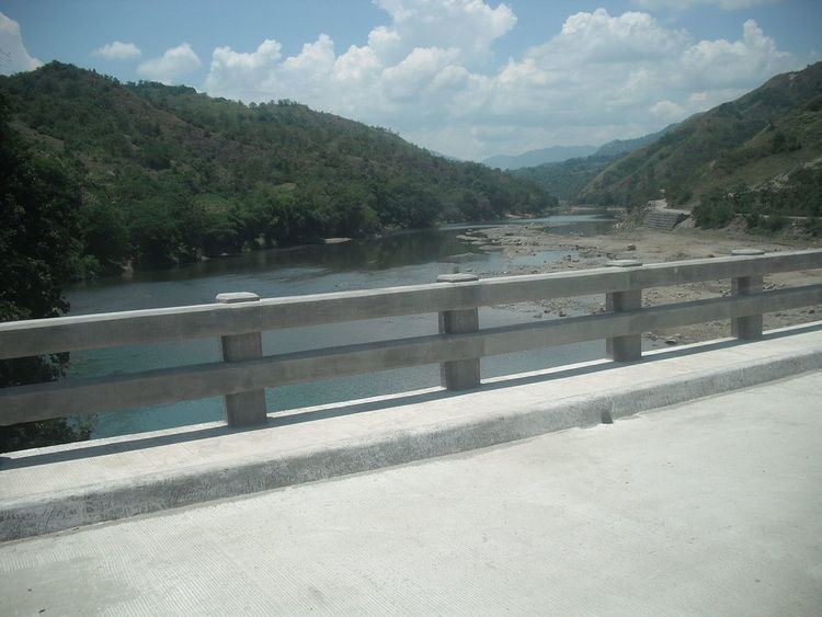
Coming from the lowlands, Cagayan-Apayao is the only road that connected the selected towns to the mountain towns of Cagayan and Apayao, located at about 1,200 meters as the highest point located in Rizal, Cagayan . The road is situated 110 Kilometers long and the way to it is hilly. A 57 Kilometer Hilly way covered the lowlands of Piat and Tuao. The upward climbing views the scenic spots of The Biuag and Malana site also known as Mount Maoanan and the rest of the ways views the 1,400 meter high mountain range of Mount Malaueg and Mount Annaguan. This road also replicates the Kennon Road of Baguio but directly at the town of Rizal only.
There are also barangays by passing the way. Most of these settlements live at the edge of the road. The majestic Matalag River is also present besides the road. The road is 500 meters above sea level and a steep high road elevating up to 1,000 meters is seen directly in the Pueblo of Rizal and the highest point of 1,200 meters is the road elevation of Mount Annaguan.
Towns ahead Cagayan
The following are the towns that links beneath the respective road (Figure stands for the total length of each road in a current town): Tuguegarao City (Don-Domingo Market - Buntun Highway) - Solana, Cagayan (Maddarulug - onwards) - Piat, Cagayan (Approach - Dugayung) - Tuao, Cagayan (Sta. Barbara - Bulagao) - Rizal, Cagayan (Gaddangao - Duyun) - Conner, Apayao (Poblation) -
Road Hazards
Cagayan-Apayao road is also one of the most hazardous roads most especially in rainy seasons. The way from Tuguegarao towards Piat and Tuao is safe to travelers and it has complete concrete roads while the ways in Tuao towards Rizal and Conner is hazardous most especially in an occurrence of Rainy seasons or sudden Earthquake that might cause landslides. The road approaching the first barangay of Rizal has concrete ways but the Mount Maoanan road is currently in construction and it is 10 kilometers long. Many travelers here most especially passenger vehicles are first should be well conditioned and has higher suspension elevation. Cars like the ones with lower suspension elevation are not allowed here but only like SUV's, Buses, Trucks, Passenger Vans and Jeepneys are allowed.
Road Construction 2011 - present
The road construction is undergoing and it is almost done. The total length of the road to be paved in Rizal is 40 Kilometers and 18% of this are the only left unpaved. In some towns like in Tuao, Piat, and Solana, the roads are undergoing repairs. The total sum almost cost approximately 200 Million Philippine Pesos. Road paving/repairing completion is expected in the year 2013 - 2015.
Bus Lines
The Road is also a transport way of the following Bus Lines: