
Population 10,264 (2011.Ward) Dialling code 0161 | OS grid reference SJ711924 Sovereign state United Kingdom Local time Monday 2:06 AM | |
 | ||
Weather 6°C, Wind W at 13 km/h, 92% Humidity | ||
Cadishead is a suburb within the City of Salford, in Greater Manchester, England. The population of this ward taken at the 2011 census was 10,264. Historically in Lancashire, Cadishead is the most southwesterly settlement in the city of Salford.
Contents
Map of Cadishead, UK
History
The earliest record of Cadishead date to 1212, and show that the whole of Cadishead – then called Cadewalesate – was rented from King John by Gilbert Notton for four shillings (20p) a year, a sum equivalent to about £650 today. The name derives from the Old English words wælla and set, and Cada, a personal name; it means the "dwelling or fold by the stream of a man called Cada".
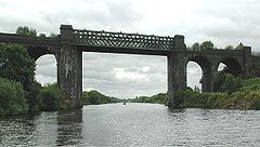
Until the early 19th century most of the area was part of the peat bog known as Chat Moss, but by 1805 work had started to reclaim the land. The opening of the Manchester Ship Canal in 1894 had a major effect on the subsequent development of Cadishead.
Location
Cadishead is situated between Irlam and Hollins Green/Rixton, either side of Liverpool Road (the B5320) and adjacent to the Manchester Ship Canal and the M62 motorway, close to the border between Greater Manchester and Warrington.
Industry
The Northbank Industrial Park dominates the east of Cadishead and the border with Irlam and supplies many jobs to the local area.
Notable People
Notable people from Cadishead include Ray Lowry, a painter and cartoonist with his most famous work being the London Calling album cover for the Clash.