Country United States Population 51,245 (2011) Unemployment rate 12.3% (Feb 2015) Area 177.40 sq mi | Founded December 17, 1771 Mayor Hon. Bobby Ramirez Kurtz (PPD) | |
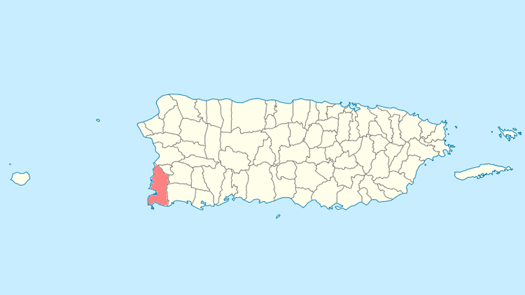
Cabo Rojo is a municipality situated on the southwest coast of Puerto Rico and forms part of the San German–Cabo Rojo metropolitan area as well as the larger Mayaguez–San German–Cabo Rojo Combined Statistical Area.
Contents
- Map of Cabo Rojo Puerto Rico
- Cabo rojo puerto rico
- History
- Geography
- Tourism
- Culture
- Economy
- Festivals and events
- References
Map of Cabo Rojo, Puerto Rico
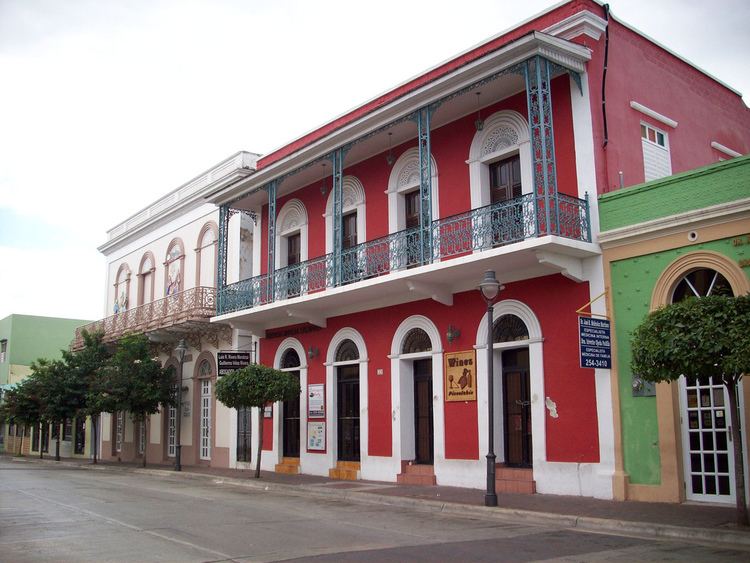
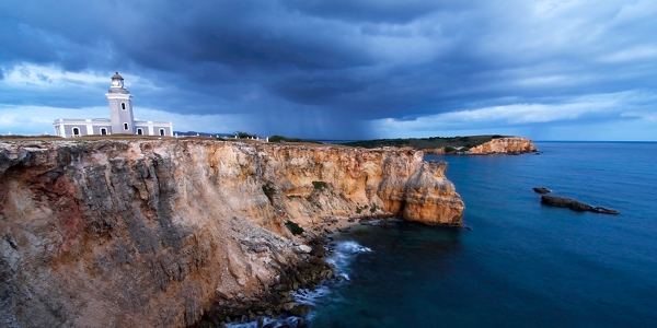
Cabo Rojo (Red Cape in English) derives its name from both the reddish color of its salt-flats and the reddish tint that characterizes the seaside cliffs along its southern coast. According to legend, the name was given by Christopher Columbus himself, although this is highly unlikely. The first church, founded in 1783, was called San Jose. The present-day main catholic church is called San Miguel Arcangel Church located in the towns square.
People from the El Combate barrio are known as mata con hacha ("those who kill with axes") based on an old folk tale about a fight over the salinas, where those from Cabo Rojo fought with axes against people from the adjacent town of Lajas. The latter apparently fought back by throwing stones and are thus known as tira piedras ("those who throw stones").
Cabo rojo puerto rico
History
The area of near Las Salinas (salt flats) has been inhabited since 30 BC and AD 120 according to archaeological evidence. Punta Ostiones, listed in the National Register of Historic Places as an archeological site, was home to a large group of Archaic Indians.
Despite the threat of pirates and Indians, the Spanish settled the area of Los Morrillos around 1511. By 1525, salt mining was an important industry in the area.
According to Fray Inigo Abbad y Lasierra by the end of the 18th century, Cabo Rojo had a population of 1,215 people.
In 1759 the first request to establish itself as a town was denied. Cabo Rojo was founded on December 17, 1771 by Nicolas Ramirez de Arellano, a descendant of Spanish royalty and nobility, with the approval of Governor Miguel de Muesas.
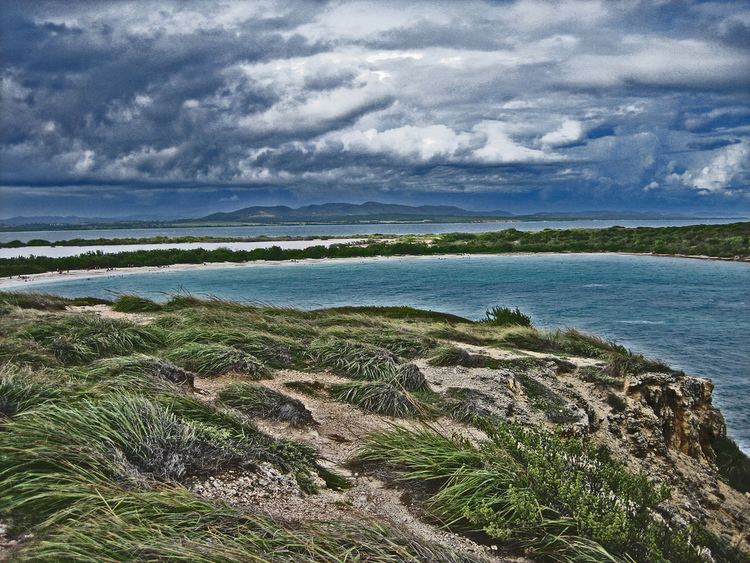
Geography
The Municipality of Cabo Rojo sits in the southern-west corner of the island of Puerto Rico, on the Western Coastal Plains. It is bordered by Mayaguez and Hormigueros to the north, San German and Lajas to the east, the Caribbean Sea to the south and the Mona Passage to the west. Cabo Rojo has a surface area of 72 square miles (187 km2).
Cabo Rojos terrain is mostly plain. However, some notable peaks are Mariquita, Buena Vista, Vargas, and Penones de Melones.
Tourism
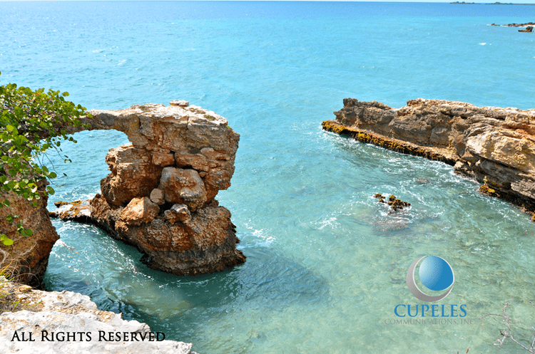
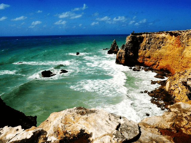
Its tourism industry has flourished with the development of hotels and marinas, but local and international environmentalists are concerned that this development will endanger Cabo Rojos rich and beautiful beaches, sunsets and natural resources. Cabo Rojo is also well known for its fishing, particularly the Puerto Real fishing village, and its many seafood restaurants, most of which are found in the village of Joyuda.
Culture
Cabo Rojo had a BSN basketball team, Los Turistas de Cabo Rojo (the "Cabo Rojo Tourists") from 1989 to 1993.
Indias de Mayaguez, female Volleyball team from Liga de Voleibol Superior Femenino played the 2009 season at the Coliseo Rebekah Colberg Cabrera, because their home ground, Palacios de los Deportes, was under remodeling.
Economy
Festivals and events