
Country Vietnam Seat Can Thanh Town Time zone ICT (UTC+07) | Centrally governed city Ho Chi Minh City Town, communes 1 thị trấn, 6 xã Area 704 km² | |
 | ||
Website cangio.hochiminhcity.gov.vn | ||
Can gio family boat tour things to do in vietnam les rives australia international school
Cần Giờ is a coastal suburban district of Hồ Chí Minh City, Southeast region, Vietnam.
Contents
- Can gio family boat tour things to do in vietnam les rives australia international school
- Map of CE1BAA7n GiE1BB9D Ho Chi Minh Vietnam
- Geographical location
- Administration
- References
Map of C%E1%BA%A7n Gi%E1%BB%9D, Ho Chi Minh, Vietnam
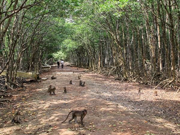
The district is located 50 km from downtown Hồ Chí Minh City. As of 2010, this district had an area of 704 km², population of 70,697, comprising Kinh people (80%), Khmer Krom and Cham people. Cần Giờ is home to Cần Giờ Mangrove Forest, a biosphere reserve listed by UNESCO.
Geographical location
Cần Giờ borders Nhà Bè District to the north, Long An and Tiền Giang provinces to the west, Đồng Nai Province to the northeast, Bà Rịa-Vũng Tàu Province to the southeast, and the East Sea to the south.
Administration
Cần Giờ district includes the town of Cần Thạnh, and six (6) communes:
Besides, it comprises 69 cays of various sizes.
References
Cần Giờ District Wikipedia(Text) CC BY-SA