
Time zone EET (UTC+2) Area code(s) +373 43 Area 1,163 km² Local time Wednesday 2:10 AM | Postal Code 243 Car plates CS Population 92,000 (2012) | |
 | ||
Weather 6°C, Wind E at 8 km/h, 94% Humidity Points of interest Monument to Suvorov, Noul Neamț Monastery, Kotovsky Museum | ||
Căușeni is a district (Moldovan: raion) in the central part of Moldova, with the administrative center at Căușeni. The other major city in the district is Căinari. As of 1 January 2011, its population was 92,300.
Contents
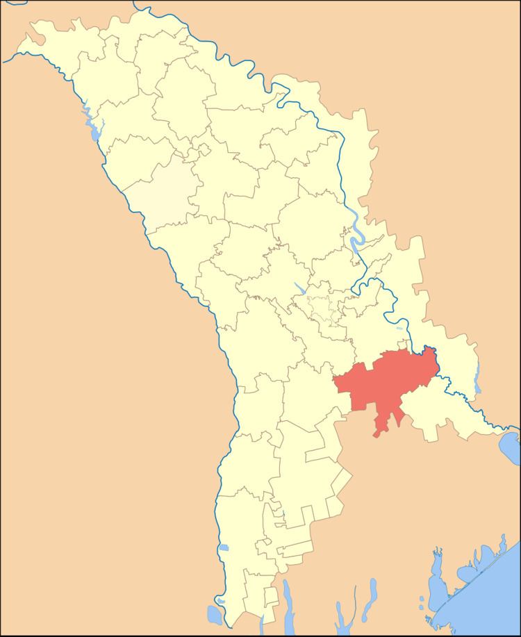
- Map of CC483uC899eni District Moldova
- History
- Geography
- Climate
- Fauna
- Flora
- Rivers
- Administrative subdivisions
- Communes in Cueni district
- Demographics
- Religion
- Economy
- Education
- Politics
- Culture
- Health
- Tourism
- References
Map of C%C4%83u%C8%99eni District, Moldova
History
The Căușeni District was the first district of Moldova to be recorded in 1455. The next localities of the region to be recorded were: Zaim, Cîrnăţeni, Fîrlădeni, but not until the period 1535-1573. In the 16th-18th centuries, intensive agriculture and wine-making industries developed and population grew as a consequence. In 1761, in Căuşeni city, the Assumption Church was built with beautiful painted frescoes on the inside walls. In 1812, after the Russo-Turkish War (1806-1812), Basarabia was occupied by the Russian Empire until 1917. During this period there was an intense Russification of the native population. In 1918, after the collapse of the Russian Empire, Bessarabia united with Romania. From 1918-1940 and again from 1941-1944 during the German occupation, the district became part of Tighina County. After the Molotov-Ribbentrop Treaty in 1940, Basarabia was occupied by the USSR until the German invasion in 1941. In 1991 as a result of the proclamation of the Independence of Moldova, part of Căuşeni joined with Tighina County (1991-2003). In 2003 Căuşeni became an administrative unit of Moldova.
Geography
Căușeni district is located in the southern part of Moldova. It consists of the following districts: Ialoveni and Anenii Noi in the north, Slobozia District in the east, Ştefan Vodă District in the south-east, bordering in the south with Ukraine, and Cimişlia District in the west. The Relief of the land is mostly flat, with maximum altitudes of 220–230 metres. The minimum altitude is 20–30 metres on the Lower Nistru plain. The land has a low intensity of erosion.
Climate
Căușeni district has a continental climate with an annual average district temperature of +10.5-11 °C. The July average temperature is +22-23 °C, and in January it is -4 °C. Annual precipitation 450–550 mm. Average wind speed is 2–5 metres/second.
Fauna
Typical European fauna, with the presence of such mammals such as foxes, hedgehogs, deer, wild boar, polecat, wild cat, ermine and others. Of birds there are: partridges, crows, eagles, starlings, swallows and more.
Flora
Forests of the district are composed of tree species such as oak, ash, hornbeam, linden, maple, walnut and others. Other common plants are: wormwood, knotweed, fescue, and nettle.
Rivers
Căușeni district is located in the Nistru river basin, whose main tributary is the Botna river (152 km). Most lakes are artificial in origin.
Administrative subdivisions
Communes in Căușeni district
- Baccealia
- Baimaclia
- Chircăiești
- Chircăieștii Noi
- Cîrnățeni
- Cîrnățenii Noi
- Ciuflești
- Coșcalia
- Fîrlădeni
- Grădinița
- Grigorievca
- Hagimus
- Opaci
- Pervomaisc
- Plop-Știubei
- Săiți
- Sălcuța
- Tănătari
- Tănătarii Noi
- Taraclia
- Tocuz
- Ucrainca
- Ursoaia
- Zaim
- Copanca (claimed by Transnistria)
- Chițcani (controlled by Transnistria)
- Cremenciug (controlled by Transnistria)
- Gîsca (controlled by Transnistria)
Demographics
As of 1 January 2012, the district population was 92,000 of which 26.5% was urban and 73.5% was rural population
Religion
Economy
The main economic activities of the district are agriculture and manufacturing. Currently there are 15,721 registered companies in the district. The different types of manufacturing that predominate are: wine-making, processing of milk, bakery products, and other industries based on local raw materials. Total Agricultural land is 93,700 ha which is (80.5%) of the total land area. Of this Agricultural land, Arable land occupies 70 600 ha (60.7%) of which there are 4,300 ha of orchards (3.7%) and 5,200 ha of vineyards (4.5%).
Education
The district operates 69 educational institutions, including institutions of secondary education - 37 (14,960 students), kindergartens - 31 (3014 children), a creative center for children.
Politics
Causeni district has historically voted mainly for right-wing parties. In Moldova the district is represented by the Alliance for European Integration (AEI). The Party of Communists of the Republic of Moldova (PCRM) has seen a continuous fall in the percentage of the vote during the last three elections.
During the last three elections the vote for the AEI has grown from 11,179 votes to 20,140 votes representing an increase of 80%.
Culture
In the Căușeni District there are: 37 houses of culture, several folk bands with a Title 31 model, and 74 amateur artistic groups with a total of 1200 participants. There is a School of Arts in Căuşeni city, a school of Music in both Căinari and Copanca, a museum of history and ethnography of Căuşeni, the "Alexei Mateevici House Museum" in Zaim, and in Cainari, a Museum of history and ethnography in Copanca, and 45 public Libraries including 9 branches for children].
Health
Health services are provided in Căușeni District through: a general fund hospital with 292 beds, 19 Magnetic field imaging (MFI) units, 13 health centres, 5 health points, and 13 clinical diagnostic laboratories.