
Admin. region Darmstadt Time zone CET/CEST (UTC+1/+2) Area 106.6 km² Local time Tuesday 8:07 PM | Postal codes 35510 Population 24,993 (30 Jun 2009) Postal code 35510 | |
 | ||
Weather 6°C, Wind W at 11 km/h, 85% Humidity | ||
Butzbach old town germany travel video
Butzbach ( [ˈbʊtsbax]) is a town in the Wetteraukreis district in Hessen, Germany. It is located approximately 16 km south of Gießen and 35 km north of Frankfurt am Main.
Contents
- Butzbach old town germany travel video
- Map of Butzbach Germany
- Boroughs of Butzbach
- Twin towns sister cities
- Sons and daughters of the town
- References
Map of Butzbach, Germany
In 2007, the town hosted the 47th Hessentag state festival from 1 to 10 June.
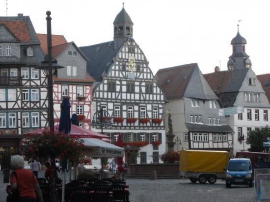
The "Landgrafenschloss" ("landgraves' castle"), used by the United States Army until 1990, is now utilized by the city council. The so-called "Roman Way Housing" of the United States Army with more than 1000 apartments was returned to the German Government in October 2007 and since has been renovated and rented out to the public. The town's market place is enclosed by timber framing. The "Schrenzer" hill (or Heidelbeerberg, 385 m) overlooks the town and the country north of Frankfurt, called Wetterau. Another much higher mountain nearby is the Hausberg which features a look-out tower.
Boroughs of Butzbach
Butzbach consists of the boroughs Bodenrod, Butzbach (urban core), Ebersgöns, Fauerbach vor der Höhe, Griedel, Hausen-Oes, Hoch-Weisel, Kirch-Göns, Maibach, Münster, Nieder-Weisel, Ostheim, Pohl-Göns and Wiesental.