
Country Ukraine First mentioned 1373 Elevation 207 m (679 ft) Area 12 km² Local time Tuesday 3:26 PM | District Tiachiv Raion Town status 1957 Time zone EET (UTC+2) Population 8,620 (2016) Province Zakarpattia Oblast | |
 | ||
Weather 12°C, Wind NE at 5 km/h, 60% Humidity | ||
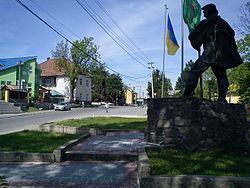
07 01 2016 bushtyno mvi 0592
Bushtyno (Ukrainian: Буштино, Hungarian: Bustyaháza, Romanian: Buştea, Yiddish: בישטינא) is an urban-type settlement in Tiachiv Raion (district) of Zakarpattia Oblast (region) in western Ukraine. The town's population was 8,506 as of the 2001 Ukrainian Census. Current population: Population: 8,620 (2016 est.). Bushtyno is located in a small valley where the Tereblia and the Tisza rivers meet.
Contents
- 07 01 2016 bushtyno mvi 0592
- Map of Bushtyno Zakarpatska Ukraine
- 07 01 2016 bushtyno mvi 0626
- References
Map of Bushtyno, Zakarpatska, Ukraine
The settlement was first mentioned in 1373 as the village of Bushta. In 1910, the settlement belonged to the Máramaros County of the Kingdom of Hungary. At the time the settlement was known as Bustyaháza, a Hungarian variant of the name, and contained a total of 2,056 inhabitants, the majority of which were Ruthenians.
In 1930, the settlement's Jewish population was 1,042. In 1957, the settlement was granted the status of an urban-type settlement. In 1995, the settlement was renamed from Bushtyna (Ukrainian: Буштина) to the current "Bushtyno."