
Country United States County Harvey FIPS code 20-09575 Elevation 442 m Zip code 67020 Local time Tuesday 3:31 AM | Time zone CST (UTC-6) GNIS feature ID 0477984 Area 230 ha Population 888 (2013) Area code 620 | |
 | ||
Weather 2°C, Wind W at 11 km/h, 44% Humidity | ||
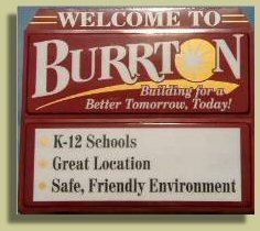
Burrton is a city in Harvey County, Kansas, United States. It is named after Isaac T. Burr, former vice-president of the Atchison, Topeka and Santa Fe Railway. As of the 2010 census, the city population was 901.
Contents
- Map of Burrton KS 67020 USA
- 19th century
- Geography
- 2010 census
- 2000 census
- Education
- Notable people
- References
Map of Burrton, KS 67020, USA
19th century
For millennia, the land now known as Kansas was inhabited by Native Americans. In 1803, most of modern Kansas was secured by the United States as part of the Louisiana Purchase. In 1854, the Kansas Territory was organized, then in 1861 Kansas became the 34th U.S. state. In 1872, Harvey County was founded.
Burrton was laid out in 1873. It was named from Burrton Township, which was named for I. T. Burr, a railroad official. The first post office in Burrton was established in June 1873. Burrton was incorporated as a city in 1878.
Burrton's location at the junction of two railroads made it an important regional shipping point.
Geography
Burrton is located at 38°1′21″N 97°40′20″W (38.022573, -97.672316). According to the United States Census Bureau, the city has a total area of 0.90 square miles (2.33 km2), all of it land.
2010 census
As of the census of 2010, there were 901 people, 347 households, and 237 families residing in the city. The population density was 1,001.1 inhabitants per square mile (386.5/km2). There were 396 housing units at an average density of 440.0 per square mile (169.9/km2). The racial makeup of the city was 93.9% White, 0.4% African American, 1.1% Native American, 0.1% Asian, 2.7% from other races, and 1.8% from two or more races. Hispanic or Latino of any race were 6.2% of the population.
There were 347 households of which 36.0% had children under the age of 18 living with them, 54.5% were married couples living together, 9.8% had a female householder with no husband present, 4.0% had a male householder with no wife present, and 31.7% were non-families. 26.2% of all households were made up of individuals and 9.2% had someone living alone who was 65 years of age or older. The average household size was 2.60 and the average family size was 3.14.
The median age in the city was 36.2 years. 30.2% of residents were under the age of 18; 6.7% were between the ages of 18 and 24; 23.6% were from 25 to 44; 26.1% were from 45 to 64; and 13.4% were 65 years of age or older. The gender makeup of the city was 47.3% male and 52.7% female.
2000 census
As of the census of 2000, there were 932 people, 361 households, and 251 families residing in the city. The population density was 1,520.9 people per square mile (589.9/km²). There were 402 housing units at an average density of 656.0 per square mile (254.4/km²). The racial makeup of the city was 93.78% White, 0.97% African American, 0.43% Native American, 2.25% from other races, and 2.58% from two or more races. Hispanic or Latino of any race were 5.15% of the population.
There were 361 households out of which 33.0% had children under the age of 18 living with them, 57.1% were married couples living together, 8.9% had a female householder with no husband present, and 30.2% were non-families. 26.0% of all households were made up of individuals and 10.0% had someone living alone who was 65 years of age or older. The average household size was 2.58 and the average family size was 3.08.
In the city, the population was spread out with 28.2% under the age of 18, 10.4% from 18 to 24, 28.8% from 25 to 44, 19.5% from 45 to 64, and 13.1% who were 65 years of age or older. The median age was 34 years. For every 100 females there were 96.2 males. For every 100 females age 18 and over, there were 93.9 males.
As of 2000 the median income for a household in the city was $33,646, and the median income for a family was $37,174. Males had a median income of $29,643 versus $21,477 for females. The per capita income for the city was $14,835. About 9.9% of families and 11.6% of the population were below the poverty line, including 18.4% of those under age 18 and 7.9% of those age 65 or over.
Education
Burrton is home to USD 369 Burrton Public Schools.
The Burrton Chargers won the following Kansas State High School championships: