
Population 330 Local time Tuesday 5:28 AM District Shepway | Sovereign state United Kingdom Postcode district TN29 | |
 | ||
Weather 4°C, Wind NW at 13 km/h, 95% Humidity | ||
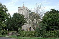
Burmarsh is a village and civil parish in the Shepway District of Kent, England. The village is located three miles (4.8 km) west of Hythe on the Romney Marsh. The Burmarsh Road connects the village to the Burmarsh Road train station.
Map of Burmarsh, Romney Marsh, UK
In the 1870s Burmarsh was described by John Marius Wilson as:
"...a parish in Romney-Marsh district, Kent; on the coast, adjacent to the Military canal... Acres, 1,796. Real property, £4,612. Pop., 170. Houses, 32."
According to the 2011 Census there were 170 males and 160 females living in the parish.
References
Burmarsh Wikipedia(Text) CC BY-SA