Kalpana Kalpana (Editor)

Burin Peninsula

Updated on
Edit
Like
Comment
Share on FacebookTweet on TwitterShare on LinkedInShare on Reddit
Province
  
Newfoundland and Labrador

Burin Peninsula httpsicbcca129303181422064749fileImageh

Burin peninsula trails 2012


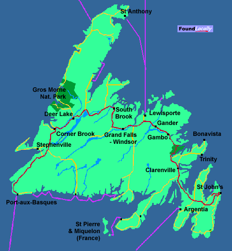
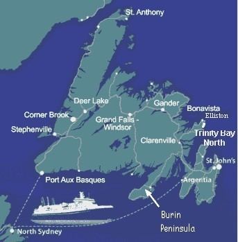
The Burin Peninsula is a peninsula located on the south coast of the island of Newfoundland in the province of Newfoundland and Labrador.

Contents

Burin Peninsula Burin Peninsula Newfoundland

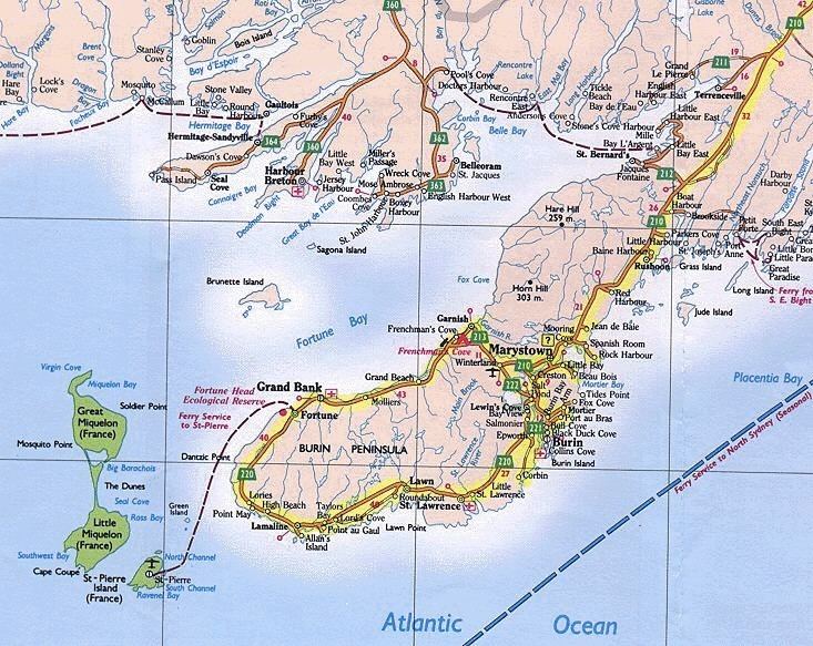
The Burin Peninsula extends to the southwest from the main island of Newfoundland, separating Fortune Bay to the west from Placentia Bay to the east. It measures approximately 130 km (81 mi) in length and between 15 to 30 kilometres (9.3–18.6 mi) in width. It is connected by a 30 km (19 mi) wide isthmus between Terrenceville and Monkstown.

Burin Peninsula FORTUNE Newfoundlandwhere the past meets the future

It was originally named the Buria Peninsula by fishermen from the Basque region during the 16th century.

Road trip burin peninsula newfoundland


Fishing

Burin Peninsula Community of Parker39s Cove Burin Peninsula wwwnewfoundla Flickr

For centuries there were plentiful cod, other fish and crustaceans, which supplied a thriving fishing industry. The eventual collapse of the Atlantic northwest cod fishery led to local mass unemployment during the second half of the 1990s.

Communities

Burin Peninsula Digital Collections 188039s Newfoundland A Pictorial Burin Peninsula

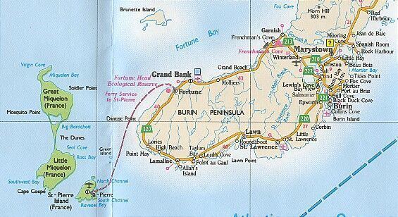
Route 210 traverses the length of the Burin Peninsula, running along the northwest side of the peninsula between Marystown and Fortune. Route 220 runs from Fortune to Marystown on the southern side. A short connecting road Route 222 runs between these two roads west of Marystown. Routes 211, 212, 213, and 221 are numbered local roads.

Burin Peninsula Coastline in St Lawrence Burin Peninsula wwwnewfoundlan Flickr

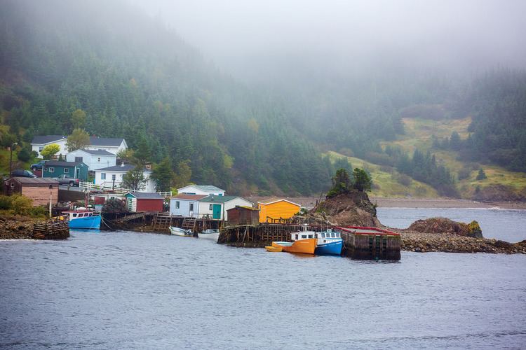
The Burin Peninsula's economy is tied to the ocean, consequently most of its settlements are located on the coast; some are outports and have no road connection.

Communities on the north coast of the peninsula, beginning in the east:

  • Terrenceville
  • Harbour Mille
  • Little Harbour East
  • Bay L'Argent
  • Jacques Fontaine
  • St. Bernard's-Jacques Fontaine
  • Garnish
  • Frenchman's Cove
  • Grand Bank
  • Fortune
  • Communities on the south coast of the peninsula, beginning in the west:

    Image result for st john's newfoundland map
  • Lories
  • Point May
  • Calmer
  • High Beach
  • Allan's Island
  • Lamaline
  • Point au Gaul
  • Taylor's Bay
  • Lord's Cove
  • Roundabout
  • Lawn
  • Little St. Lawrence
  • St. Lawrence
  • Epworth
  • Lewin's Cove
  • Burin Bay Arm
  • Burin
  • Port au Bras
  • Fox Cove-Mortier
  • Little Bay Placentia Bay
  • Creston
  • Creston North
  • Marystown
  • Spanish Room
  • Rock Harbour
  • Jean De Baie
  • Red Harbour
  • Rushoon
  • Baine Harbour
  • Parkers Cove
  • Boat Harbour West
  • Davis Cove
  • Sandy Harbour
  • Monkstown, Newfoundland and Labrador
  • Great Paradise, Placentia Bay, Newfoundland and Labrador
  • Little Paradise, Newfoundland and Labrador
  • St. Joseph's
  • Port Anne
  • Petite Forte
  • Clattice Harbour
  • Clattice South West
  • Burnt Island
  • Murphy's Cove
  • Isle Valen
  • Darby's Harbour
  • Great Bona
  • Little Bona
  • Southeast Bight
  • Toslow
  • Presque
  • Saint Annes
  • Saint Leonards

  • Burin Peninsula September 21 Marystown to Clarenville via St Lawrence and Grand Bank

    Burin Peninsula Burin Peninsula Trailways

    References

    Burin Peninsula Wikipedia