 | ||
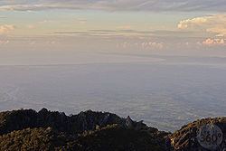
The Burica Peninsula is a coastal relief that juts south into the Pacific Ocean and is divided into two areas: the west side belongs to Costa Rica, and the area that belongs to Panama, which dominates the east and about two-thirds of the peninsula. The Costa Rican side is the southernmost of the country (except for the island of Coco). On this peninsula there are several points including Punta Burica (on the Panamanian) southernmost point of the peninsula, Punta Gorda and Punta El Mangle (both in the Costa Rican side).
Contents
Map of Peninsula Burica, Puntarenas Province, Costa Rica
InhabitantsEdit
This area is inhabited by people whose main activity is fishing. On the Panamanian side stand the city of Puerto Armuelles (the most populous of the peninsula) and the localities of Guanábano, Las Mellizas and Limones. On the Costa Rican side stands the village of Las Peñas.
In 2006, the Panamanian side has been allocated a special area for industrial development in the area of the twins.
