
Population (2015) 6,329 | Israeli Subdistrict Golan Area 7 km² | |
 | ||
Weather 10°C, Wind NE at 10 km/h, 56% Humidity | ||
Buq ata golan
Buq'ata (Arabic: بقعاتا; Hebrew: בֻּקְעָאתָא) is a Druze town in the northern section of the Israeli-occupied portion of the Golan Heights. Buq'ata covers an area of 7,000 dunams (7 km²) between two mountains in the Golan Heights, Mount Hermonit and Mount Varda. Located 1,070 metres above sea level, it had a population of 6,329 in 2015. Since the adoption of the 1981 Golan Heights Law, Buq'ata is under Israeli civil law, and incorporated into the Israeli system of local councils.
Contents
- Buq ata golan
- Map of Buqata
- Road from mt varda and valley of tears to buq ata
- History
- Demography
- Economy
- References
Map of Buq'ata
Granted the right to obtain Israeli citizenship following the passage of the Golan Heights Law, as of 2012 most of the residents, like the majority of Druze in the Golan Heights, adopted permanent residency but refused Israeli citizenship and instead retain Syrian citizenship. For more about the status and position of the Golan Heights Druze community see here.
Buq'ata is one of the four remaining Syrian-Druze communities on the Israeli-occupied portion of the Golan Heights, the others being Majdal Shams, Ein Qiniyye and Mas'ade. Geologically and geographically a distinction is made between the Golan Heights and Mount Hermon, the boundary being marked by the Sa'ar Stream; however, administratively usually they are being lumped together. Buq'ata and Mas'ade are on the Golan side of the boundary, characterised by black volcanic rock (basalt), while Majdal Shams and Ein Qiniyye are on the Hermon side, thus sitting on limestone.
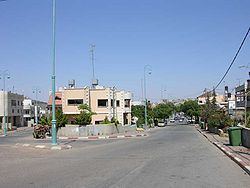
Road from mt varda and valley of tears to buq ata
History
Buq'ata was founded in the 1880s by families from the neighboring town of Majdal Shams. It was destroyed in 1888 during a series of feuds between rival villages in the area, and again in 1925, during the Great Syrian Revolt against the French mandatory rule. It became part of independent Syria in 1946.
In the course of the Six-Day War in 1967, the town was captured by Israel.
Buq'ata achieved Israeli local council status in 1982. Since the uprising in Syria, some of the violence has spilled over into Buq'ata, where residents loyal to the government of President Bashar al-Assad in Damascus have clashed with anti-Assad activists.
Demography
According to data compiled by Israel's Central Bureau of Statistics in 2001, Buq'ata ranked 2 out of 10 on the national socioeconomic index. In 2000, 72.5% of Grade 12 students graduated with a Bagrut matriculation certificate.
The inhabitants of Buq'ata have permanent residency in Israel and receive social welfare benefits from Israel.
Economy
The local economy is predominantly agricultural, with apples and grapes being the main crops. In 2013, Buq'ata harvested 55,000 tons of apples, which it sold to markets in Israel or exported to Syria. This arrangement still worked in 2013, but is under threat due to the civil war in Syria.