
Time zone CET (UTC+1) Area 131.1 km² Local time Monday 8:28 AM | Postal code 6114 Population 3,006 (2005) Area code 76 | |
 | ||
Weather 6°C, Wind SW at 14 km/h, 84% Humidity | ||
Bugac is a village in Bács-Kiskun county, in the Southern Great Plain region of southern Hungary.
Contents
Map of Bugac, 6114 Hungary
It covers an area of 131.11 km2 (51 sq mi) and has a population of 2889 people (2010).
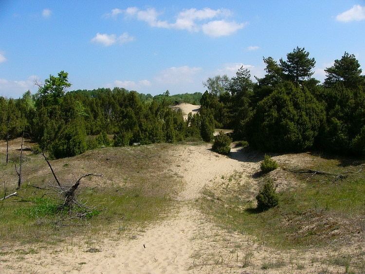
The surrounding area, Bugac puszta is the largest of seven disjoint units making up the Kiskunság National Park.
History
Bugac was founded by the local government of Kecskemet, led by Kada Elek in 1909. Originally it belonged to Kecskemét province in the 19th century.
Countryside
Although Bugac is a part of the Great Plains it is known to have a few features distinct from the plains. Sand hills, created by strong winds, cover several square kilometers of the region, resulting in a unique landscape around the village. These hills range from 10 meters to 50 meters in height. Lack of vegetation due to the poor quality of the soil in this region caused sand hills, which continually shifted and flew with the winds.
In the seventeenth century, Maria Theresa decided to stop the sand winds by afforestation. Bugac is now surrounded by forests which cover the sand hills around the countryside. This unique land form is different from the Hortobágy National Park. Bugac is the part of the Kiskunsagi National Park which is the second national park of Hungary, founded in 1975. The first national park was of the Hortobágy National Park in 1973.