
 | ||
Similar Buffalo National River, Kyles Landing Road, Hemmed‑In‑Hollow Falls, Parker–Hickman Farm Historic D, Hawk's Bill Crag Trail | ||
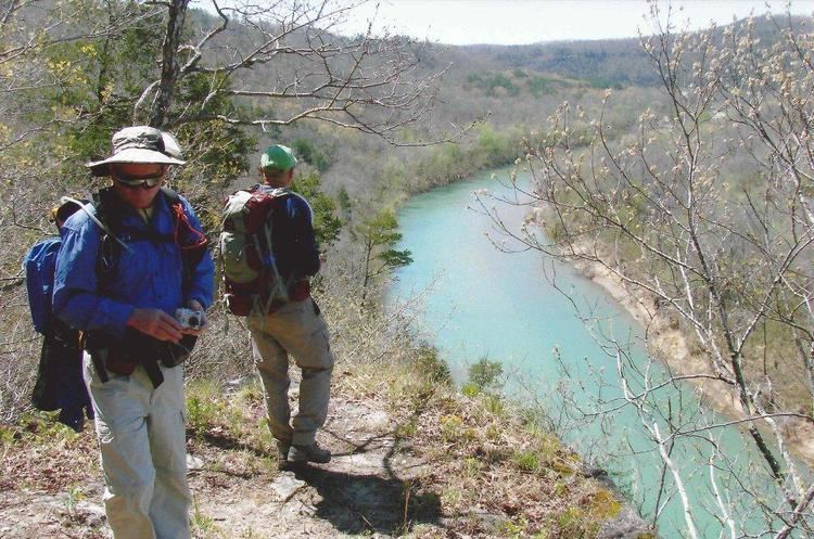
Hiking the buffalo river trail part 1 boxley to ponca
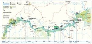
The Buffalo River Trail is a hiking and backpacking trail that follows the path of the Buffalo National River in Arkansas. It consists of two separate sections that are referred to as the Western and Eastern sections. The Western Section is from Boxley Valley to Pruitt. The Eastern Section is under development with completed segments from Woolum Ford to Highway 65 bridge at Tyler Bend and South Maumee to Highway 14 (Dillard's Ferry). The Ozark Highlands Trail joins the Eastern Section of the Buffalo River Trail at Woolum Ford so it is officially designated the Buffalo River/Ozark Highlands Trail.
Contents
- Hiking the buffalo river trail part 1 boxley to ponca
- Backpacking the buffalo river trail boxley to ponca part 1
- Course
- Development
- History
- Western Section
- Eastern Section
- Features
- Guidebooks
- Access
- References
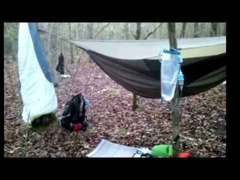
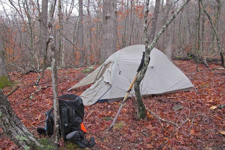
Backpacking the buffalo river trail boxley to ponca part 1
Course
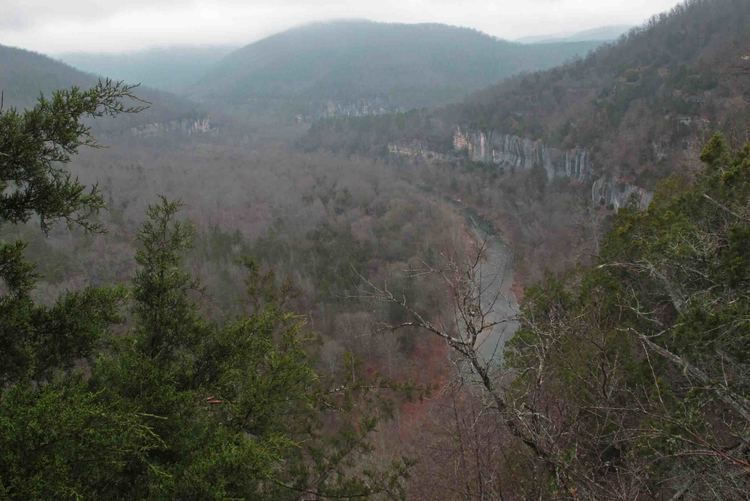
The trail follows the path of the Buffalo National River in Arkansas and traverses the rugged Buffalo River country. The route stays on the south side of the river to avoid river crossings.
Western Section
Eastern Section (under development)
Development
The trail is being developed as a cooperative effort of the NPS and volunteers. Kenneth L. Smith is the trail building volunteer coordinator. Spring work season is mid-March through early April. Fall work season is mid-October to early November.
History
In 1986 Kenneth L. Smith began his work as coordinator for development of the Buffalo River Trail.
The gap between the Western and Eastern Section is due to The Wilderness and Backcountry Management Plan released by the park service in 1994 which restricted development in areas designated as wilderness.
Western Section
Construction began on the Western Section in 1980 and by 1994 half of the 37 miles were completed.
Eastern Section
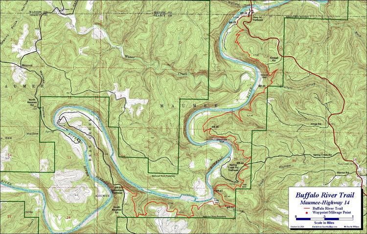
The Woolum Ford to Tyler Bend segment was completed in 1991 and the South Maumee to Hwy 14/Dillards Ferry segment was completed in 2010.
Ozark Highlands Trail Association volunteers built a 20 ft. bridge across a gulley near the Grinder's Ferry trailhead in 2015.
Features
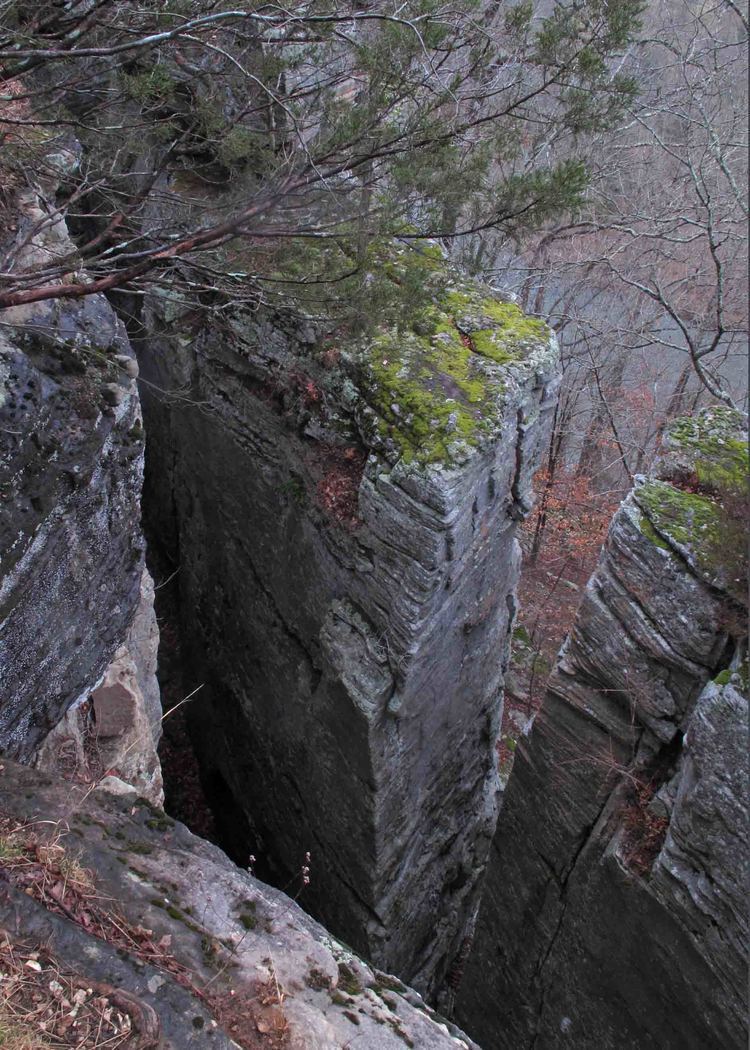
Sites on the trail include expansive views from atop bluff cliffs, abandoned homestead sites, vestiges of Civil War-era mining and logging activities and a wide variety of Ozark flora and fauna.
Guidebooks
"Buffalo River Handbook" by Kenneth L. Smith, University of Arkansas Press.
"Buffalo River Trails" by Tim Ernst, Cloudland Publishing.
Access
The Buffalo Outdoor Center in Ponca, AR offers a vehicle shuttle service for point-to-point hikers.