
Country United States Time zone Pacific (PST) (UTC-8) Elevation 221 m Zip code 98321 Local time Sunday 3:50 PM | Incorporated 1889 FIPS code 53-08570 Area 10.23 km² Population 4,453 (2013) Area code 360 | |
 | ||
Weather 7°C, Wind SE at 14 km/h, 43% Humidity | ||
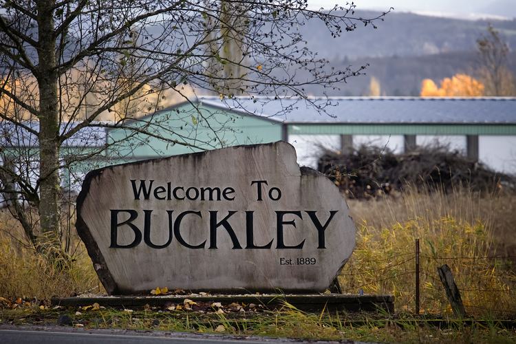
Buckley is a city in Pierce County, Washington, United States. The population was 4,354 at the 2010 census and has grown to 4,550 people as of 2015 estimate.
Contents
- Map of Buckley WA USA
- Geography
- Climate
- Demographics
- 2013
- 2010 census
- 2000 census
- History
- In pop culture
- Notable people
- References
Map of Buckley, WA, USA
Geography
Buckley is located at 47°9′44″N 122°1′40″W (47.162250, -122.027744) near the communities of Enumclaw, Bonney Lake, and Wilkeson.
According to the United States Census Bureau, the city has a total area of 3.95 square miles (10.23 km2), of which, 3.87 square miles (10.02 km2) is land and 0.08 square miles (0.21 km2) is water.
Climate
According to the Köppen Climate Classification system, Buckley has a warm-summer Mediterranean climate, abbreviated "Csb" on climate maps.
Demographics
Buckley is the home of Company A, 1st Battalion, 19th Special Forces Group (Airborne), a Special Forces National Guard unit.
2013
By 2013 city-data recordings showed an overall population of 4,453 people, 51.4% of which being male as opposed to 48.6% female. The median age stood at 35.6 years compared to that of the state of Washington, which was 37.4.
Of the reported 4,453 people, 91.8% were white alone, followed by 3.1% Hispanic, 2.9% of individuals of more than one race, 0.8% American Indian, 0.7% Asian, 0.5% Black, 0.1% Native Hawaiian or Pacific Islander, and 0.02% other race alone.
Of the members of Buckley 25 years or older, 80.7% have completed a high school education or higher, while 14.8% have completed a minimum of a bachelor's degree. 4.4% have earned a graduate or professional degree, and the unemployed rate sat at 6.9%.
Those who were 15 years or older, 47.4% were married, 36.3% never married, 2.4% separated, 1.7% widowed, and 12.2% divorced.
The median household income also differed from the state's standing at $59,852, increased by over $10,00 since 2000, compared to Washington's $58,405.
The median housing prices for overall units was $248,356, which detached houses were $263,853. Townhouses stood at $219,456, 2-unit structures at $181,905, 3 to 4-unit structures at $194,771, 5 or more-unit structures at $239,007 and finally mobile homes at a median price of $92,564.
The city's overall crime index sat well below the national average of 294.7 (per 1000) at 170.9. These figures included 0 murders, 20.3 rapes, 182.7 burglaries, 2,800.9 thefts, 324.7 auto thefts, and 101.5 counts of arson.
2010 census
As of the census of 2010, there were 4,354 people, 1,591 households, and 1,049 families residing in the city. The population density was 1,125.1 inhabitants per square mile (434.4/km2). There were 1,669 housing units at an average density of 431.3 per square mile (166.5/km2). The racial makeup of the city was 93.0% White, 0.6% African American, 0.8% Native American, 0.8% Asian, 0.1% Pacific Islander, 1.2% from other races, and 3.4% from two or more races. Hispanic or Latino of any race were 3.1% of the population. By 2014, the city's population remained 93.0% White, and a combined 3.0% Hispanic or Latino.
There were 1,591 households of which 33.7% had children under the age of 18 living with them, 48.6% were married couples living together, 11.5% had a female householder with no husband present, 5.8% had a male householder with no wife present, and 34.1% were non-families. 26.3% of all households were made up of individuals and 11.6% had someone living alone who was 65 years of age or older. The average household size was 2.50 and the average family size was 3.00.
The median age in the city was 39.9 years. 22.5% of residents were under the age of 18; 8.9% were between the ages of 18 and 24; 25.4% were from 25 to 44; 30% were from 45 to 64; and 13% were 65 years of age or older. The gender makeup of the city was 50.3% male and 49.7% female. Males remained the dominant gender still in 2014 with a recorded total of 2,191 men and 2,163 women.
2000 census
As of the census of 2000, there were 4,145 people, 1,396 households, and 995 families residing in the city. The population density was 1,072.7 people per square mile (414.6/km²). There were 1,472 housing units at an average density of 380.9 per square mile (147.2/km²). The racial makeup of the city was 93.78% White, 0.63% African American, 1.13% Native American, 0.77% Asian, 0.17% Pacific Islander, 0.55% from other races, and 2.97% from two or more races. Hispanic or Latino of any race were 1.81% of the population.
There were 1,396 households out of which 38.5% had children under the age of 18 living with them, 54.2% were married couples living together, 12.3% had a female householder with no husband present, and 28.7% were non-families. 22.1% of all households were made up of individuals and 7.2% had someone living alone who was 65 years of age or older. The average household size was 2.65 and the average family size was 3.12.
In the city, the population was spread out with 26.4% under the age of 18, 7.4% from 18 to 24, 32.4% from 25 to 44, 24.8% from 45 to 64, and 9.0% who were 65 years of age or older. The median age was 36 years. For every 100 females there were 102.3 males. For every 100 females age 18 and over, there were 106.9 males.
The median income for a household in the city was $49,453, and the median income for a family was $54,900. Males had a median income of $43,409 versus $29,688 for females. The per capita income for the city was $19,744. About 3.6% of families and 8.3% of the population were below the poverty line, including 6.4% of those under age 18 and 4.9% of those age 65 or over.
History
Taken from the files of the City of Buckley and Buckley Library