
Population 188 (2006 census) Postcode(s) 5641 Postal code 5641 | Established 1925 County Buxton Founded 1925 Local time Monday 10:12 AM | |
 | ||
Weather 19°C, Wind SE at 21 km/h, 64% Humidity | ||
Buckleboo is a locality in the Australian state of South Australia on the Eyre Peninsula located about 313 kilometres (194 mi) northwest of the state capital of Adelaide and about 31 kilometres (19 mi) northwest of the municipal seat of Kimba.
Map of Buckleboo SA 5641, Australia
Buckleboo began as a government town surveyed in November 1924. It was named in 1925 by Tom Bridges, the 19th Governor of South Australia after the cadastral unit of the Hundred of Buckleboo. Boundaries for the locality were created in 1999 and included the former government town of Buckleboo, the ceased government town of Moongi and the locality of Moongi. In 2013, a parcel of land was removed from the adjoining locality of Pinkawillinie and added to Buckleboo to ensure that the area once covered by the Buckleboo Pastoral Run was within the locality.
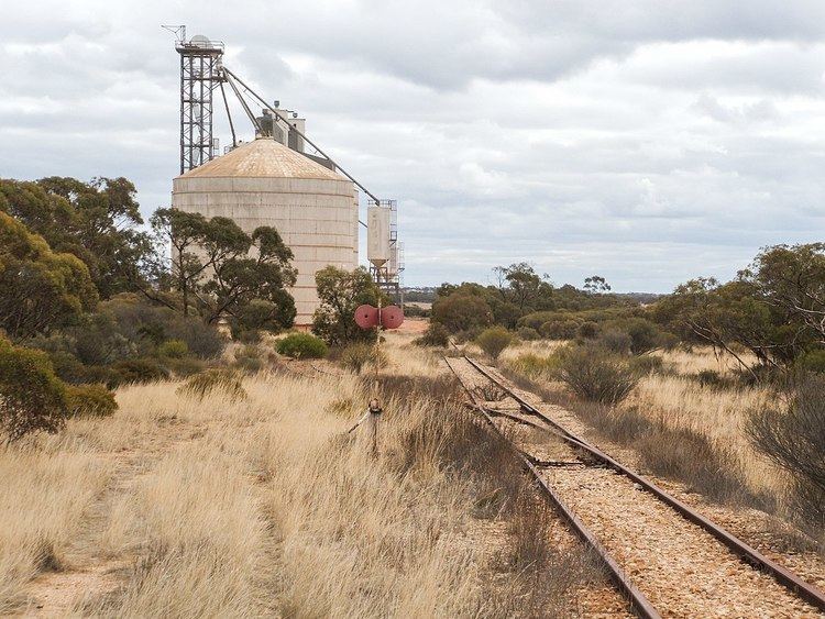
Buckleboo was until 2005 the railhead for the Eyre Peninsula Railway, a narrow gauge railway to haul grain via Kimba and Cummins to Port Lincoln for export. The silos at the former railway station and the few remaining buildings are surrounded by the Buckleboo Conservation Reserve, proclaimed in 1990.
The locality also includes the Moongi Conservation Reserve further along the railway survey, beyond where tracks were ever laid. Moongi also had a school and a Methodist Hall which opened in 1932.
Buckleboo is home to 'Buckleboo Park' which consists of six tennis courts and an oval for Australian rules football and cricket.
Buckleboo is in the local government area of the District Council of Kimba, the state electoral district of Flinders and the federal Division of Grey.