
Country United States State | Population 56,683 (2013) Area 392 sq mi Mayor Jackie A. Meck | |
 | ||
Unemployment rate 6.2% (Feb 2015) | ||
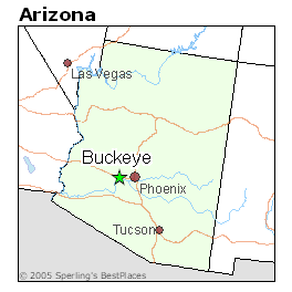
Map of Buckeye, Arizona
Buckeye is a city in Maricopa County, Arizona and is the westernmost suburb in the Phoenix metropolitan area. The population was 6,537 at the 2000 census. From 2000 to 2010, the Buckeye population growth percentage was 678.3% as it had 50,876 people at the 2010 census.
Contents
- Map of Buckeye Arizona
- Memphis best bbq buckeye arizona best bbq west of the mississippi
- Buckeye az homes for sale
- History
- Geography
- Neighborhoods
- Climate
- Demographics
- Parks and recreation
- Education
- Media
- Transportation
- Roads
- Bus
- Rail
- Air
- Notable people
- References
Memphis best bbq buckeye arizona best bbq west of the mississippi
Buckeye az homes for sale
History
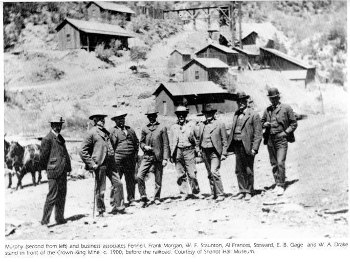
Early settler Malin M. Jackson developed 10 miles (16 km) of the Buckeye Canal from 1884 to 1886, which he named after his home state of Ohio's moniker, "The Buckeye State". The town was founded in 1888 and originally named "Sidney," after Jackson's home town in Ohio. However, because of the significance of the canal, the town became known as Buckeye. The name was legally changed to Buckeye in 1910. The town was incorporated in 1929, at which time it included 440 acres (180 ha). The town's first mayor was Hugh M. Watson (1956–1958), who founded the Buckeye Valley Bank. Today, Watson Road is the site of the city's commercial center.
In 2008, Buckeye was featured on The NewsHour with Jim Lehrer as part of a week-long series entitled "Blueprint America."
In 2013, a video featuring a Verrado High School student who overcame Down's Syndrome to join the school's cheerleading squad, and using the Katy Perry song "Roar", was selected as a finalist in a Good Morning America contest.
A vote to change the town into the City of Buckeye became effective in 2014.
Geography
Buckeye is located approximately 30 miles (48 km) west of downtown Phoenix.
According to the United States Census Bureau, the city has a total area of 145.8 square miles (377.6 km2), all of it land.
Neighborhoods
The original Buckeye was built around downtown's main street, Monroe Avenue. There are currently nearly 30 master planned communities planned for Buckeye. Such master planned communities under development in which homes are occupied include Riata West, Sundance, Verrado, Westpark, Tartesso and Festival Ranch.
Other unbuilt planned communities within Buckeye include Douglas Ranch (planned for nearly 300,000 inhabitants), Sun Valley Villages, Spurlock Ranch, Trillium, Elianto, Westwind, Silver Rock, Sienna Hills, Henry Park, Southwest Ranch and Montierre.
Sundance Towne Center, a shopping center developed by Vestar Development in the Sundance community, opened in 2007.
Climate
Buckeye has a hot desert climate (Köppen BWh), with abundant sunshine due to the stable descending air of the eastern side of the subtropical anticyclone aloft and at sea level over the southwestern US. Summers, as with most of the Desert Southwest, are extremely hot, with 121.0 afternoons reaching 100 °F or 37.8 °C and 181.6 afternoons getting to 90 °F or 32.2 °C. The record high temperature of 125 °F (51.7 °C) occurred on July 28, 1995, and temperatures above 86 °F or 30 °C may occur in any month. Less hot weather may occasionally occur during summer, but such periods are no less unpleasant as they result from monsoonal weather with its attendant higher cloudiness and humidity; however actual rainfall from the monsoon is much more infrequent than in Flagstaff, Nogales or even Tucson. The heaviest daily rainfall has been 4.90 inches (124.5 mm) on September 2, 1894, but between 1971 and 2000 no month had more rainfall than 4.52 inches or 114.8 millimetres in December 1984.
The winter season from November to March is warm to very warm during the day, not much cooler than 68 °F or 20 °C during a typical afternoon, but 20.2 mornings typically fall to or below 32 °F or 0 °C, though no snowfall was recorded during the 1971 to 2000 period, and only twelve afternoons did not reach 50 °F or 10 °C. The coldest temeprature recorded in Buckeye was 11 °F or −11.7 °C on January 8, 1913.
Demographics
As of the census of 2000, there were 6,537 people, 2,158 households, and 1,624 families residing in the town. The population density was 44.8 people per square mile (17.3/km²). There were 2,344 housing units at an average density of 16.1/sq mi (6.2/km²). The racial makeup of the town was 72.54% White, 3.37% Black or African American, 1.71% Native American, 0.44% Asian, 0.08% Pacific Islander, 19.34% from other races, and 2.52% from two or more races. Hispanic or Latino of any race were 36.65% of the population.
There were 2,158 households out of which 42.8% had children under the age of 18 living with them, 52.7% were married couples living together, 15.7% had a female householder with no husband present, and 24.7% were non-families. 20.7% of all households were made up of individuals and 7.5% had someone living alone who was 65 years of age or older. The average household size was 3.03 and the average family size was 3.47.
In the town the population was spread out with 33.8% under the age of 18, 9.8% from 18 to 24, 28.9% from 25 to 44, 19.3% from 45 to 64, and 8.2% who were 65 years of age or older. The median age was 30 years. For every 100 females there were 101.8 males. For every 100 females age 18 and over, there were 97.7 males.
The median income for a household in the town was $35,383, and the median income for a family was $39,194. Males had a median income of $32,357 versus $24,901 for females. The per capita income for the town was $15,627. About 16.2% of families and 18.8% of the population were below the poverty line, including 27.6% of those under age 18 and 13.3% of those age 65 or over.
Parks and recreation
A popular recreation destination in Buckeye is the Buckeye Hills Recreation Area. It is located 7 miles (11 km) south of downtown Buckeye on State Route 85 (at mile marker 144). A 900-acre (3.6 km2) Buckeye Lake is planned. The City of Buckeye's Skyline Regional Park is an 8,700 acre mountain preserve located in the southern White Tank Mountains. The park features 8 miles of trails for hikers, mountain bikers and equestrians, picnic areas and camping. Entry to the park is free. By the end of September 2016, 9 additional miles of trails will be constructed for a total of 17 miles of trails.
Education
The City of Buckeye is served by the following school districts:
Estrella Mountain Community College recently renovated the original historic Buckeye Union High School building on Eason Avenue near 9th Street, also known as the "A" Wing, and started holding classes in this new satellite facility in the Fall of 2011. Named the Buckeye Educational Center, this facility provides academic courses, job training programs and community education classes.
Media
There are several local newspapers including the West Valley View, Arizona Republic's Southwest Valley edition and the Buckeye Valley News.
Transportation
Buckeye is served by five highways, a municipal airport and several nearby airports, and the railroad.
Roads
Major roadways serving the city include:
Bus
Buckeye is served by Valley Metro via a rural bus line connecting Phoenix-Goodyear-Gila Bend-Ajo.
Rail
In 1910, the Arizona Eastern Railroad came to Buckeye; the first car in 1911; a steam rail line connected it to Phoenix by 1912; and a state highway by 1915. The coming of the railroad was so significant that the business district was moved to accommodate the location of the railroad station. As a result, Buckeye was booming. By 1912, major buildings were constructed, along with expansion of the business community.
Union Pacific operates a rail line running east-west generally through the center of the city.
Air
The Buckeye Municipal Airport (ICAO identifier KBXK), is owned and operated by the city government.