
First ascent 1898 | Elevation 3,639 m Prominence 396 m | |
 | ||
Easiest route Scramble/Technical class 3 to 5.8 Similar Static Peak, South Teton, Middle Teton, Mount Wister, Nez Perce Peak | ||
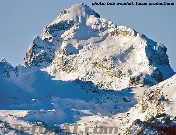
Buck Mountain 11,938 feet (3,639 m) is located in the Teton Range, Grand Teton National Park, Wyoming, immediately southeast of Grand Teton. The mountain is the highest summit south of Garnet Canyon and is easily seen from most vantage points in Jackson Hole. Views from the summit offer excellent views of the Cathedral Group to the north. The west slope of the summit tower are along the Alaska Basin Trail and extend into Caribou-Targhee National Forest and the Jedediah Smith Wilderness, which is the location of Alaska Basin, a popular wilderness camping area for backpackers. Timberline Lake is located on the eastern flanks of the peak.
Map of Buck Mountain, Wyoming 83414, USA
The summit was first climbed on August 21, 1898 by T.M. Bannon and George Buck, only ten days after Grand Teton was first climbed by another party. Bannon later became the first person to climb Borah Peak, the tallest mountain in the state of Idaho.