
Country Thailand Time zone THA (UTC+7) Geocode 3012 | Seat Bua Yai Postal code 30120 Area 271.6 km² | |
 | ||
Province Nakhon Ratchasima Province | ||
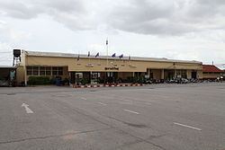
Bua Yai (Thai: บัวใหญ่) is a district (amphoe) in the northern part of Nakhon Ratchasima Province, northern central Thailand.
Contents
Map of Bua Yai District, Nakhon Ratchasima, Thailand
History
Bua Yai dates back to the frontier town called Dan Nok (ด่านนอก). The center of the town was Ban Nong Lang Yai. In 1868, it was upgraded to be Amphoe Dan Nok and the town center was moved to Ban Nong Lang Noi. The district office was moved again to Ban Bua Yai in 1905, and the district was renamed accordingly. The office was 3 km from the Bua Yai railway junction. The presence of the railway spurred development of the village Ban Fat Fueay which became the new location of the district office in 1951.
Geography
Neighboring districts are (from the north clockwise) Waeng Noi of Khon Kaen Province, Bua Lai, Sida, Non Daeng, Khong, Ban Lueam and Kaeng Sanam Nang of Nakhon Ratchasima Province.
Administration
The district is subdivided into 10 subdistricts (tambon). The town (thesaban mueang) of Bua Yai covers part of the tambon Bua Yai.
The missing numbers are tambon which now form the districts Kaeng Sanam Nang, Sida and Bua Lai.