
Local time Sunday 12:16 PM | ||
 | ||
Location 474 km (295 mi) SW of Sydney52 km (32 mi) NW of Wagga Wagga8 km (5 mi) W of Coolamon6 km (4 mi) W of Ganmain Weather 28°C, Wind SW at 10 km/h, 37% Humidity | ||
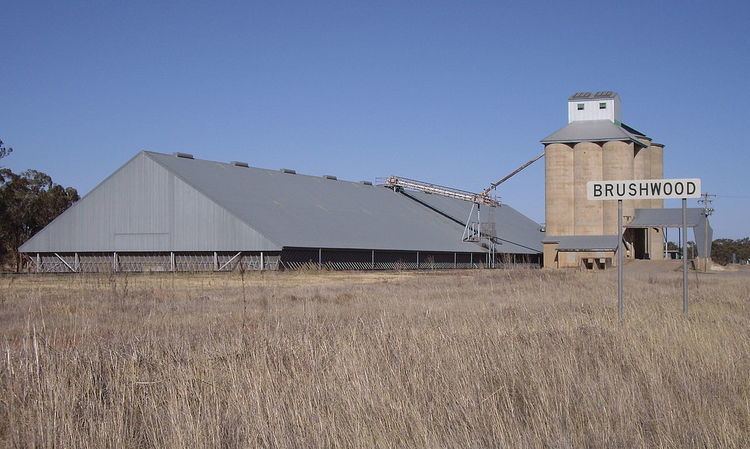
Brushwood is a rural community in the central east part of the Riverina region of New South Wales, Australia. It is situated by road about 6 kilometres (3.7 mi) east from Ganmain and 8 kilometres (5.0 mi) west from Coolamon.
Brushwood lies within the wheat farming belt of the Coolamon Shire Council and is the home of a small railway station (for the uploading of wheat and other grains) and a series of large 30-metre (98 ft) silos.
References
Brushwood, New South Wales Wikipedia(Text) CC BY-SA