
 | ||
Google road trip st albert alberta canada to brownvale alberta canada
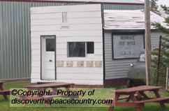
Brownvale is a hamlet in northern Alberta, Canada within the Municipal District of Peace No. 135. It is located on Highway 737 less than 1 kilometre (0.62 mi) off Highway 2, approximately 48 kilometres (30 mi) southwest of the Town of Peace River and 20 kilometres (12 mi) southwest of Grimshaw. Duncan's First Nation reserve is less than 5 km (3.1 mi) to the south.
Contents
- Google road trip st albert alberta canada to brownvale alberta canada
- Map of Brownvale AB Canada
- Demographics
- References
Map of Brownvale, AB, Canada
The community originated in the mid-1920s when the railway was extended from Berwyn to Whitelaw. The town was named after John Brown who came to the area in 1913. In 1924 his homestead was chosen for the location of the community.
Demographics
As a designated place in the 2016 Census of Population conducted by Statistics Canada, Brownvale recorded a population of 115 living in 54 of its 59 total private dwellings, a change of 2999200000000000000♠−8% from its 2011 population of 125. With a land area of 3.06 km2 (1.18 sq mi), it had a population density of 37.6/km2 (97.3/sq mi) in 2016.
As a designated place in the 2011 Census, Brownvale had a population of 125 living in 51 of its 56 total dwellings, a 14.7% change from its 2006 population of 109. With a land area of 3.38 km2 (1.31 sq mi), it had a population density of 36.98/km2 (95.8/sq mi) in 2011.