
Country United States Time zone CST (UTC-6) Elevation 173 m Local time Saturday 1:14 PM | Established November 4, 1856 ZIP codes 61924, 61944 Area 82.93 km² Population 235 (2010) | |
 | ||
Weather 10°C, Wind S at 23 km/h, 45% Humidity | ||
Brouilletts Creek Township is one of fifteen townships in Edgar County, Illinois, USA. As of the 2010 census, its population was 235 and it contained 114 housing units.
Contents
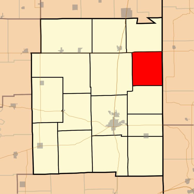
- Map of Brouilletts Creek Township IL 61924 USA
- Geography
- Extinct towns
- Cemeteries
- School districts
- Political districts
- References
Map of Brouilletts Creek Township, IL 61924, USA
Geography
According to the 2010 census, the township has a total area of 32.02 square miles (82.9 km2), all land.
Extinct towns
Cemeteries
The township contains these twelve cemeteries: Adams, Allen, Cameron, Houseton, Igo, Littlefield, McCauley, Mount Carmel, Newcomb, Newton, Old Scott and Sugar Grove.
School districts
Political districts
References
Brouilletts Creek Township, Edgar County, Illinois Wikipedia(Text) CC BY-SA