
Country United States County Schoharie FIPS code 36-10154 Elevation 351 m Population 947 (2000) | State New York Time zone Eastern (EST) (UTC-5) GNIS feature ID 0978760 Local time Saturday 12:48 PM | |
 | ||
Weather -10°C, Wind NW at 35 km/h, 43% Humidity Area 124.6 km² (123.8 km² Land / 78 ha Water) | ||
History
The town was one of the six original towns when the county was formed in 1797. Originally, named the "Town of Bristol," the name was changed to "Broome" in 1811.
Contents
Few settlers came to Broome until after the American Revolution.
Past residents of note
Geography
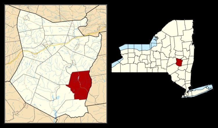
According to the United States Census Bureau, the town has a total area of 48.1 square miles (125 km2), of which, 47.8 square miles (124 km2) of it is land and 0.3 square miles (0.78 km2) of it (0.58%) is water.
The east town line is the border of Albany County.
Catskill Creek originates in Broome.
New York State Route 145 is a north-south highway through Broome.
Demographics
As of the census of 2000, there were 947 people, 407 households, and 260 families residing in the town. The population density was 19.8 people per square mile (7.7/km²). There were 767 housing units at an average density of 16.1 per square mile (6.2/km²). The racial makeup of the town was 96.41% White, 0.74% African American, 0.32% Native American, 0.11% Asian, 0.74% from other races, and 1.69% from two or more races. Hispanic or Latino of any race were 1.80% of the population.
There were 407 households out of which 23.8% had children under the age of 18 living with them, 53.6% were married couples living together, 5.9% had a female householder with no husband present, and 36.1% were non-families. 30.0% of all households were made up of individuals and 12.3% had someone living alone who was 65 years of age or older. The average household size was 2.33 and the average family size was 2.91.
In the town, the population was spread out with 20.9% under the age of 18, 5.8% from 18 to 24, 25.4% from 25 to 44, 29.4% from 45 to 64, and 18.5% who were 65 years of age or older. The median age was 44 years. For every 100 females there were 99.8 males. For every 100 females age 18 and over, there were 103.0 males.
The median income for a household in the town was $32,368, and the median income for a family was $40,167. Males had a median income of $30,500 versus $23,750 for females. The per capita income for the town was $16,383. About 5.4% of families and 8.4% of the population were below the poverty line, including 2.5% of those under age 18 and 9.0% of those age 65 or over.