
Sovereign state United Kingdom Postcode district TN25 Local time Saturday 6:15 AM | Post town TONBRIDGE Area 4.01 km² Dialling code 01233 | |
 | ||
Population 310 (Civil Parish 2011) Weather 8°C, Wind SW at 8 km/h, 94% Humidity | ||
Brook is a small village and civil parish in the Ashford borough of Kent, England, centred 4.5 miles (7.2 km) ENE of Ashford.
Contents
Map of Brook, UK
Geography
Brook is in a gently rolling valley top immediately south of the North Downs. The brook referred to rises here and flows east to join the combined East and West Stour, that is, the River Great Stour. The south-east fifth of the parish is woodland. Brook has a small village museum. The human population of this area rose by 3 during the 10 years to the United Kingdom Census 2011.
History
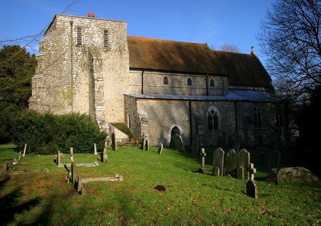
The 11th century Grade I listed parish church is dedicated to St Mary. There is also a Baptist chapel. The church of St. Mary, erected about 1075, is of stone, in the Early Norman style, and has a tower containing 3 bells: the tower was struck by lightning in 1896, and the northwest corner destroyed, but was restored in 1899: there are 160 sittings.