
Population 1,242 (2011 Census) Community Bronington Country Wales Local time Saturday 5:15 AM | OS grid reference SJ484395 Sovereign state United Kingdom Dialling code 01948 UK parliament constituency Clwyd South | |
 | ||
Weather 6°C, Wind S at 16 km/h, 88% Humidity | ||
Bronington is a local government community, the lowest tier of local government, part of Wrexham County Borough in Wales. The community has an area of 3,482 hectares and a population of 1,228 (2001 Census), increasing to 1,242 at the 2011 Census.
Contents
Map of Bronington, Whitchurch, UK
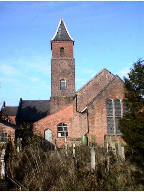
The village church, Holy Trinity, was converted from a former brick tithe barn in 1836. To the north-east of the village is Iscoyd Hall, a stately home with surrounding parkland which was built around 1740 and enlarged in the 19th century. South of the village is Fenn's Moss, an area of peat bog stretching over into Shropshire, which was declared a national nature reserve in 1996 because of its importance for wildlife.
Governance
An electoral ward in the same name exists. This ward stretches north-west to Bangor-on-Dee with a total population at the 2011 Census of 3,179.