
Population 314 (2011 census) Postcode district IP12 2 Local time Saturday 4:24 AM | Sovereign state United Kingdom | |
 | ||
Weather 7°C, Wind S at 11 km/h, 96% Humidity | ||
Bromeswell is a village and civil parish in the Suffolk Coastal district of Suffolk, England about 2 miles east of Woodbridge.
Map of Bromeswell, Woodbridge, UK
Bromeswell shows many of the characteristics of a traditional English village. It is one of the most secluded, beautiful spots in Suffolk. It contains many forests, a nature reserve, a spectacular boardwalk, lakes, and the Deben river runs through it.
Situated near the River Deben, Bromeswell lies on fairly high and fertile ground with low-lying heathland to the South and marshland to the West.
A mile to the south west is Sutton Hoo, the Ango-Saxon burial site situated alongside the River Deben.
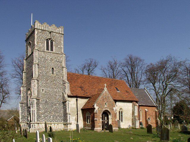
The parish church of Bromeswell is situated in what is considered the centre of the village. The church has roots from several centuries ago, with a tower to the West, a vestry to the North and a South porch. The church consists of various additional features from various centuries.
Bromeswell lacks most public amenities but has a bus stop, functioning red telephone box, post box and traditional village inn, the Bromeswell Cherry Tree.