
- elevation 3 ft (1 m) Basin area 284.9 km² | Length 21 km Basin area 284.9 km² | |
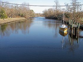 | ||
The Broadkill River is a river flowing to Delaware Bay in southern Delaware in the United States. It is 13.3 miles (21 km) long and drains an area of 110 square miles (285 km²) on the Atlantic Coastal Plain.
Contents
Map of Broadkill River, Lewes, DE, USA
The Broadkill flows for its entire length in eastern Sussex County. It issues from Wagamons Pond in the town of Milton; the pond is fed by two tributaries known as Ingram Branch and Pemberton Branch. From Milton, the Broadkill River flows generally eastwardly, passing through wetlands and salt marshes in the Prime Hook National Wildlife Refuge. After approaching to within one quarter mile (0.5 km) of Delaware Bay, the river parallels the shoreline a short distance inland for approximately two miles (3 km) before flowing into the bay, approximately one mile (1.6 km) northwest of Lewes. The United States Coast Guard maintains a station near the mouth of the Broadkill. The mouth is connected to Rehoboth Bay by the Lewes and Rehoboth Canal, which forms part of the Atlantic Intracoastal Waterway.
In the 19th century the river was the center of a regional shipbuilding industry, arising from the access it furnished to inland forests; the industry fell into decline in the 1890s.
A footpath known as the Governors Walk follows the Broadkill in central Milton. The Nature Conservancy established a preserve along the river downstream of Milton in 1998. As of 2005, an annual canoe and kayak race was being held on the river in Milton.
Variant names and spellingsEdit
The United States Board on Geographic Names issued an opinion clarifying "Broadkill River" as the stream's name in 1961. According to the Geographic Names Information System, it has also been known historically as: