
OS grid reference SD866239 District Rossendale | Postcode district OL13 Dialling code 01706 | |
 | ||
Weather 6°C, Wind SE at 11 km/h, 95% Humidity | ||
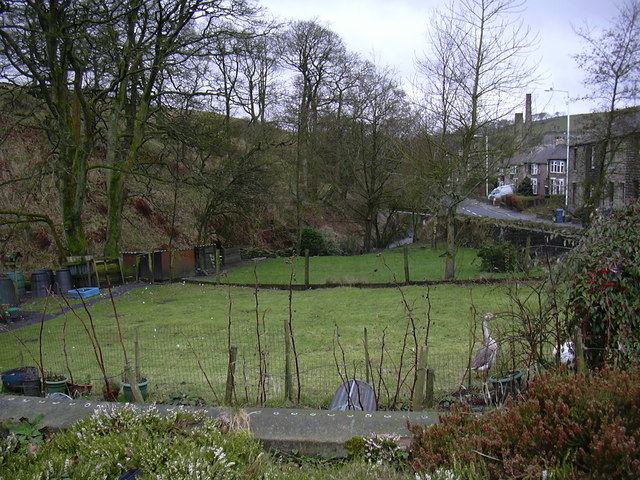
Broadclough – historically Broad Clough (meaning "broad valley") – is a village located to the north of Bacup (where population details are included), previously having been a part of the old Borough of Bacup and now with Rossendale borough of Lancashire and part of the Greenclough Ward. It is part of the Rossendale and Darwen constituency, with Jake Berry having been the Member of Parliament since 2010. Like much of Bacup, Broadclough is rapidly becoming a commuter area for towns such as Manchester, Burnley, Accrington, Preston, Blackburn, Rochdale (and further afield).
Contents
Broadclough is serviced by Broadclough Lodge which is a special school and the mixed maintained North Primary School which sits at the top of the ridge of the clough from which the village gets its name. Children at Northern Primary School may take an 11 Plus exam to be considered for selection to Bacup and Rawtenstall Grammar School.
History
The Goidelic Celts occupied the area around Broadclough and wolves were encountered in the hills around the clough as late as the 13th century.
Broadclough Dykes
The village is significant in that there exists what has been argued to be the most important archaeological site in the East Lancs area, namely Broadclough Dykes. It has been claimed that in the 10th century, the Anglo-Saxons battled against Gaels and Norsemen at Broadclough, with some arguing this was the setting for the site of, or an encampment of an army before the Battle of Brunanburh.
Although the Dykes near Dykes House Farm have been studied, there are other earthworks, specifically those that run next to the Roman Road and Lane Head Farm, Bacup Old Road and Plantation View in neighbouring Weir, which have yet to be investigated. In addition there are other properties which aren't associated with the Dykes such as Dikes Barn Farm which suggest there may be other locations in Broadclough that need to be analysed.
Others have suggested these are of Roman rather than Saxon origin, whilst others believe it's of bronze age origin, sharing its history with other bronze age features nearby.
The prevailing train of thought places Broadclough Dykes as an ancient structure, however there is a suggestion that it may actually have an industrial origin as open-cast site for extraction of fireclay, from beneath an exposed coal seam.
Broadclough Buildings
Before Bacup rose in significance and before deafforestation, Broadclough historically sat in The Forrest of Rossendale's Newchurch township, being a clough within the Bacup Booth. Broadclough Hall at Lower Broadclough was the seat of the Whittaker family, one of the most important families in the Forest of Rossendale, who held the position of Greave of the Forest as a quasi-hereditary title from around 1515. Considered the only "ancient hall" in Rossendale. Broadclough Hall was originally built around 1596, with a coach house believed to date from circa 1750 featuring a rare recessed/rebated frontage with veranda. The hall had a number of notable visitors including Beatrix Potter and John Wesley. The present building was built in 1816, being the third hall to be built on the site, although it is likely a building had existed on or near the site previously.
Whilst many of Broadclough's buildings where built by the Whittakers of Broadclough Hall, a family by the name of Lord grew to become a significant property owner and there are a number of listed buildings within Broadclough that are associated with them, as well as a number of place names (including Lord's Court and Lord's Barn).
After over a hundred years of trading and having lost its licence in 1959, in 1971, Broadclough's only pub, The Roebuck (opposite Lord's Court), was demolished as part of the Bacup slum clearance, allowing Burnley Road to be straightened.
Transport
Higher Broadclough (at Broadclough Farm and Step Row) was originally the furthest point of the road that is now A671 before it turned 90 degrees and headed up through the farm yard, past the notable Step Row and up the road that is now Bacup Old Road. There is also an old bridge (extant but no longer in use) which probably predates the 18th Century and which sits 10 metres south east of Dog Pits Lane having once served to connect Bacup Old Road to Todmorden Old Road before the turnpike was built.
Parliament enacted the Rochdale to Burnley Turnpike Trust in 1755, which extended the main road through the village to Weir, making Burnley much more accessible to road traffic.
The section of Burnely Road that runs through Broadclough has become an accident blackspot, where speeding is seen as a problem on the road, with people into Broadclough from Weir often driving like they’re still in open countryside according to local residents whilst Councillor Jimmy Eaton said: "It’s not that long ago that a lady was killed not so far away from where this accident took place, and that wasn’t the first. There have been many accidents along that stretch in recent times and I'm very concerned that there will be another fatality if something isn’t done." The County Councillor has gone on to spearhead residents' calls for the creation of a bypass with the suggestion of utilising elements of the old highway Bacup Old Road.
There have been several attempts to further develop Broadclough; however, to date these have been refused on several grounds of which the main concerns have been the impact on the open countryside and moorlands and of Burnley Road, on which there has been a large number of accidents. The land on the boundary of Weir, adjacent to Broadclough Farm and Northern Primary School, has had several attempts at development including a 61-home plan as well as an 80-bed residential care unit which was refused locally and had an appeal dismissed by the planning inspectorate.
In June 2014 the police announced they would be monitoring the A671 between Weir and Bacup (which passes through Broadclough) as it has become an accident blackspot with a high number of accidents which have resulted in serious injury and even deaths.
Broadclough is served by the Transdev Number 8 bus between Burnley and Bacup, with Stops near York Street, Northern Primary School, Broadclough Mill and Meadows Mill.
Industry
There was around 50 farms owned by the Whittaker family in the Broadclough area in the 17th century however the industrial history of the area rapidly progressed with Broadclough becoming one of the first areas to industrialized, firstly through water mills off the River Irwell, notably those off Dog Pits Lane, opposite Broadclough Farm/ behind Lord's Court and Higher Broad Clough Mill, which was also known as the Owd Engine/Old Engine. These early mills were quickly replaced by steam powered spinning mills including the early 19th century Broadclough Mill and Meadows Mill.
The Grade 2 Broadclough Mill was built in 1824 as a successful water powered woolen mill which became steam powered by the 1830s, becoming a cotton spinning mill following enlargement and was later separated out into business units which is how it operates today. Broadclough Mill is the traditional starting point of the Bacup and Stacksteads Carnival parade which takes place each year in June.
There was also a colliery in the village known as Broadclough Colliery Coal Mine which was owned by George Hargreaves & Co, was operational by 1894 employing 3 men underground and one above ground however was disued by 1931. Broadclough has one of the most significant gravity mine water discharges in the UK which flows from the Old Meadows mine area of Broadclough, through the Broadclough Minewater Treatment Works to the River Irwell close to Broadclough Mill.
Broadclough Residents Group is currently in the process of developing a plan to plant trees on former industrial or built areas of the hamlet to preserve an understanding of the area's industrial past. In September 2015 it was announced the Broadclough Residents Group had been awarded almost 500 saplings by the Woodland Trust to plant around the area.
Geography
The geography of Broadclough is central to the settlements development. It being a three sided valley which is cut through at the North East end by the River Irwell which runs the length of Broadclough. There is a trig point on the summit of Brex Height above Broadclough which marks the extent of the village's hinterland to the west. The Trig Point pillar built in May 1948 and was last maintained by the OS in October 1979. Brex Height is also the 12th highest summit in the West Pennines at 409 m (1342 ft).