
Phone +61 13 19 63 | ||
 | ||
Hours Open today · 7AM–9PMSaturday7AM–9PMSunday7AM–9PMMonday7AM–9PMTuesday7AM–9PMWednesday7AM–9PMThursday7AM–9PMFriday7AM–9PM Similar Maribyrnong River, Organ Pipes National, Pipemakers Park, Westerfolds Park, Jells Park | ||
2015 brimbank park
Brimbank Park is a State park situated in the north-western Melbourne suburb of Keilor, Victoria, Australia. (Melway ref: 15 A10). Entry is via Keilor Park Drive which is off the Western Ring Road.
Contents
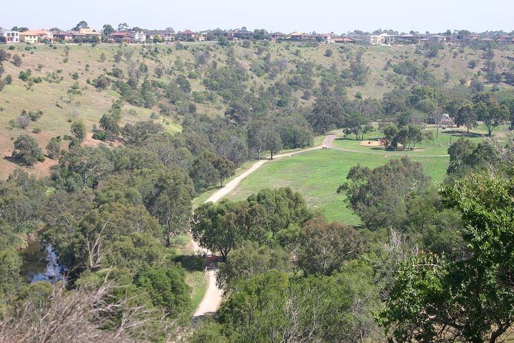
In 1976 Brimbank Park was opened as part of the Maribyrnong Valley Park, combined with the adjacent Horseshoe Bend Children's farm and Greenvale Reservoir Park. The Maribyrnong River has hollowed out a valley some 55 metres below the Keilor Plain, with a steep bank on the northern side and gentle terraces on the southern side forming a huge amphitheatre.
The park has several sheltered picnic areas, gas barbecues, picnic tables, and playgrounds. For those who forget their picnic basket, there is the Leaping Lizard Cafe in the visitors centre. A network of cycling and walking tracks cross the park, as well as self-guided walking trails. For the adventurous, the Maribyrnong River Trail starts at the park and follows the tree lined river 25 km to Footscray.
A wetlands area has been extensively revegetated. Birds commonly seen in the park include blue wrens, yellow-tailed thornbills, flame robins, parrots and galahs, and a variety of water birds. Residing in the River Red Gums are Brush-tailed and Ring-tailed possums. You may see a Blue-tongued lizard sunbaking, or catch sight of some swamp wallabies.