
- elevation 465 m (1,526 ft) - elevation 417 m (1,368 ft) | - location Allanwater Bridge Source Pakashkan Lake | |
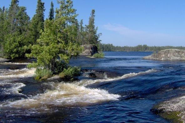 | ||
Dangerous waters on brightsand river solo 2016 march 15th 2016
The Brightsand River is a river in the James Bay drainage basin in Unorganized Thunder Bay District in northwestern Ontario, Canada.
Contents
- Dangerous waters on brightsand river solo 2016 march 15th 2016
- Current breaking up the ice on brightsand river solo 2016 march 17th 2016
- Course
- Tributaries
- References
Current breaking up the ice on brightsand river solo 2016 march 17th 2016
Course
The river begins at Outlet Bay on Pakashkan Lake about 45 kilometres (28 mi) northeast of the community of Upsala. It flows north through Brightsand Lake and further to Wapakaimaski Lake. The river splits with one channel flowing west into Seseganaga Lake and further into Kawaweogama Lake; the other flows north through Antler Lake and McEwan Lake. The two combine again to form the river Allan Water at the community of Allanwater Bridge, the location of Allanwater Bridge railway station, served by Via Rail transcontinental Canadian trains, on the Canadian National Railway transcontinental main line.
Most of the river has been designated Brightsand River Provincial Park.