
Region Qikiqtaaluk Area 271 km² | Population Uninhabited Max length 46 km | |
 | ||
Island group Canadian Arctic Archipelago | ||
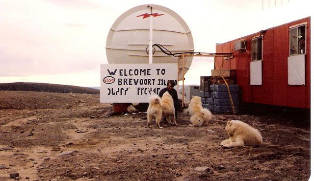
Brevoort Island is a small, uninhabited island located in the Labrador Sea off the eastern coast of Baffin Island in the Qikiqtaaluk Region of northern Canada's territory of Nunavut. The island is a member of the Canadian Arctic Archipelago and lies north of Cape Murchison, opposite the Cumberland Peninsula.
Contents
Map of Brevoort Island, Baffin, Unorganized, NU, Canada
Geography
Brevoort Island, with an area of 271 km2 (105 sq mi), is 46 km (29 mi) in length, and 5–7 km (3.1–4.3 mi) in width. It has a hilly interior, mostly composed of granite.
Military use
The island was the home of BAF-3, a Distant Early Warning Line and now a North Warning System site. It has a non-radar, rearward communications (relay) station.
References
Brevoort Island Wikipedia(Text) CC BY-SA