
Local time Friday 3:17 AM | ||
 | ||
Weather 4°C, Wind S at 18 km/h, 94% Humidity | ||
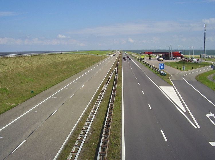
Breezanddijk (West Frisian: Breesândyk) is a small community that lies near the midpoint of the Afsluitdijk, part of the A7 motorway, in the Netherlands. It lies on a former artificial island which was created during the construction of the dam, and it belongs to the municipality of Súdwest-Fryslân, in Friesland province. The hamlet lies between Den Oever and Kornwerderzand. Until 2011 it was part of the former municipality of Wûnseradiel, merged with the other 4 to form the new Súdwest-Fryslân.
Map of Breezanddijk, Netherlands
The construction of the Afsluitdijk was started at four points: on both sides of the mainland and on two specially made construction-islands (Kornwerderzand and Breezanddijk) along the line of the future dyke. There are about 40-50 buildings, most of which are bunkhouses that were built for the workers employed during the construction of the Afsluitdijk. Today, it has a population of only four and its sole commercial establishment is a Texaco gas station for travelers upon the dyke. There are two small harbours, one on the North Sea side of the dyke, and the other on the IJsselmeer side