
Area 2.5 sq mi (6.5 km) OS grid reference SK834069 Local time Thursday 7:54 PM Dialling code 01572 | Population 392 2001 Census Unitary authority Shire county Rutland | |
 | ||
Weather 5°C, Wind SW at 13 km/h, 63% Humidity | ||
Braunston-in-Rutland is a village and civil parish in the county of Rutland in the East Midlands of England. The population of the civil parish was 392 at the 2001 census, including Brooke and increasing to 502 at the 2011 census. Leicestershire lies on the parish's western boundary
Contents
Map of Braunston-in-Rutland, UK
Braunston is located roughly three miles (4.8 km) south-west of the county town of Oakham. The River Gwash flows through the village.
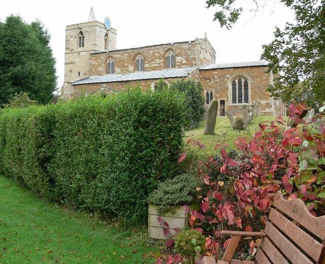
The village retains two public houses, The Old Plough, and the 17th-century Blue Ball Inn. The parish church, which has a circular churchyard, is dedicated to All Saints.
The Braunston "Goddess"
A sculpted stone stands in the churchyard, at the west end of the church, close to the tower. Known as the Braunston "Goddess", it was found in about 1920 when the church doorstep needed to be replaced. When the slab was lifted the carving was revealed on the underside. There has been considerable speculation as to its age and meaning, and its original position as part of the church building, or whether it may even predate the church. It is clearly not a gargoyle as it has no drainage channel. It may have had an apotropaic purpose. It has facial and stylistic similarities with some Irish Sheela na Gigs, but it has no genitalia.