
Coat of arms Flag Population (2010 Census) 102,600 inhabitants | Area 7.63 km (2.95 sq mi) | |
 | ||
Density 13,446.92/km (34,827.4/sq mi) | ||
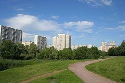
Brateyevo District (Russian: райо́н Брате́ево) is a district of Southern Administrative Okrug of the federal city of Moscow, Russia, located in the southeast of Moscow on the right bank of the Moskva River. Population: 102,600 (2010 Census); 94,644 (2002 Census). The area of the district is 7.63 square kilometers (2.95 sq mi).
Contents
Map of Brateyevo District, Moscow, Russia
History
Several pagan mounds dated back to ancient settlements have been discovered on the territory of Brateyevo District. The settlement transformed into the prosperous village located on the Brateyevo hill which later gave its name to the district. In 1960 Brateyevo village became administrative part of Moscow. In the 1980s Brateyevo village has been demolished during the construction of the modern district.
Metro
Nearest stations, which are not located in Brateyevo District but accessible using public transportation: