
Car plates NBR Population 43,781 (2006) | Area 1,205 km² | |
 | ||
Gminas Total 7 (incl. 1 urban)BraniewoGmina BraniewoGmina FromborkGmina LelkowoGmina PieniężnoGmina PłoskiniaGmina Wilczęta Points of interest Muzeum Mikołaja Kopernik, Archcathedral Basilica of the Assu, Muzeum Pomnika Historii Fr, Rynek we Fromborku, Szpital św Ducha | ||
Braniewo County (Polish: powiat braniewski) is a unit of territorial administration and local government (powiat) in Warmian-Masurian Voivodeship, northern Poland, on the border with Russia. It came into being on January 1, 1999, as a result of the Polish local government reforms passed in 1998. Its administrative seat and largest town is Braniewo, which lies 80 kilometres (50 mi) north-west of the regional capital Olsztyn. The county also contains the towns of Pieniężno, lying 27 km (17 mi) south-east of Braniewo, and Frombork, 11 km (7 mi) west of Braniewo.
Contents
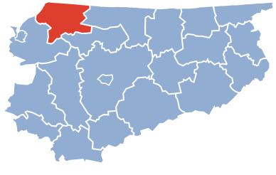
Map of Braniewo County, Poland
The county covers an area of 1,204.54 square kilometres (465.1 sq mi). As of 2006 its total population is 43,781, out of which the population of Braniewo is 17,875, that of Pieniężno is 2,915, that of Frombork is 2,529, and the rural population is 20,462.
Neighbouring counties
Braniewo County is bordered by Bartoszyce County and Lidzbark County to the east, and Elbląg County to the south-west. It also borders Russia (Kaliningrad Oblast) to the north.
Administrative division
The county is subdivided into seven gminas (one urban, two urban-rural and four rural). These are listed in the following table, in descending order of population.