
Local time Thursday 6:03 PM | ||
 | ||
Weather -1°C, Wind S at 3 km/h, 81% Humidity | ||
Brandval is a parish and former municipality in Hedmark county, Norway.
Contents
Map of 2219 Brandval, Norway
Brandval is located in the Norwegian traditional district of Solør. The parish forms the northern part of Kongsvinger municipality. Brandval is situated north of Kongsvinger on the Glåma river. Brandval was separated from Grue municipality in 1867. In 1941 part of Grue was transferred into Brandval. The municipalities of Brandval and Vinger were merged with the city and municipality of Kongsvinger in 1964.
Finnskogen or the Finn's forest is a belt about 32 km (20 mi) wide and running continuously along the frontier in the districts of Austmarka, Brandval, Grue, Hof, Åsnes, and Våler.
The name
The municipality (originally the parish) is named after the old farm Brandval (Norse Brandváll), since the first church was built there (in 1651). The first element is brandr m 'fire; burning', the last element is váll m 'clearance made by the use of fire'.
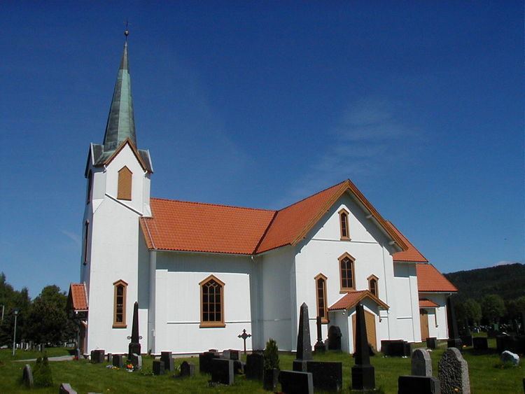
Brandval Church
Brandval church (Brandval kirke) is a neo-Gothic, cruciform church dating from 1651. the church was built of wood. The church was subject to a restoration in 1839 and underwent a renovation in 1876-77. Johan Heinrich Günther Schüssler was the architect behind the rebuilding. The baroque pulpit and altar date from 1651. They were made by Lauritz Lauritzen and painted by Thomas Blix in 1728. The Baptismal font is from the Middle Ages.