Samiksha Jaiswal (Editor)

Brandhorn (Steinernes Meer)

Updated on
Edit
Like
Comment
Share on FacebookTweet on TwitterShare on LinkedInShare on Reddit
Isolation
  
2.6 km → Hochseiler

Elevation
  
2,610 m

Brandhorn (Steinernes Meer) httpsuploadwikimediaorgwikipediacommonsthu

Parent range
  
Steinernes Meer, Berchtesgaden Alps

Ranges
  
Steinernes Meer, Berchtesgaden Alps

Similar
  
Wildalmkirchl, Hochseiler, Selbhorn, Schönfeldspitze, Breithorn

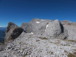
The Brandhorn is a mountain, 2,610 m (AA), in the Berchtesgaden Alps in the Austrian state of Salzburg. It lies in the southeast of the Steinernes Meer, at the crossing to the Hochkönig. After the Selbhorn (2,655 m) and Schönfeldspitze (2,653 m) the Brandhorn is the third highest peak in the Steinernes Meer.

Contents

Ascent

The path from the Riemannhaus to the Matrashaus – and thus the E4 alpin long distance path – runs over the Brandhorn. grade I–II, walking duration: 10–12 hours.

Other summit approaches:

  • From the Eckbert Hut along the Bohlensteig and Torscharte, I–II, partly secured, 4 hours
  • From the Steinhütterl via the Mauerscharte gap and the Alpriedelhorn, trackless, 3½ hours
  • From Hinterthal via the Torscharte gap
  • Literature

  • Bernhard Kühnhauser (2011). Alpenvereinsführer Berchtesgadener Alpen mit Hochkönig (20th ed.). Munich: Bergverlag Rother. pp. 426–429, 568. ISBN 978-3-7633-1127-9. 
  • References

    Brandhorn (Steinernes Meer) Wikipedia