
State California Incorporated July 26, 1957 FIPS code 06-07946 Area 5.071 km² Population 1,077 (2013) Area code 626 | Time zone PST (UTC-8) Elevation 206 m Zip code 91008 Local time Friday 10:41 PM | |
 | ||
Weather 14°C, Wind NE at 3 km/h, 31% Humidity | ||
The bradbury estate bradbury california
Bradbury is a city in the San Gabriel Valley region of Los Angeles County, California, United States. It is located in the foothills of the San Gabriel Mountains below Angeles National Forest. Bradbury is bordered by the city of Monrovia to the west, and Duarte to the south and east. The population was 1,048 at the 2010 census, up from 855 at the 2000 census. The city has three distinct areas—the Bradbury Estates, which is a gated community consisting of 5-acre (20,000 m2) minimum estates; Woodlyn Lane, which is also a gated community with minimum 2-acre (8,100 m2) lots; and the balance of the city, which is not gated, which has lots generally ranging in size from 7,500 square feet (700 m2) to 1-acre (4,000 m2). A significant portion of the properties in Bradbury Estates and Woodlyn Lane are zoned for horses, and several horse ranches still exist within these communities today.
Contents
- The bradbury estate bradbury california
- Map of Bradbury CA 91008 USA
- History
- Geography
- 2010
- 2000
- Education
- Government
- Public safety
- Notable people
- References
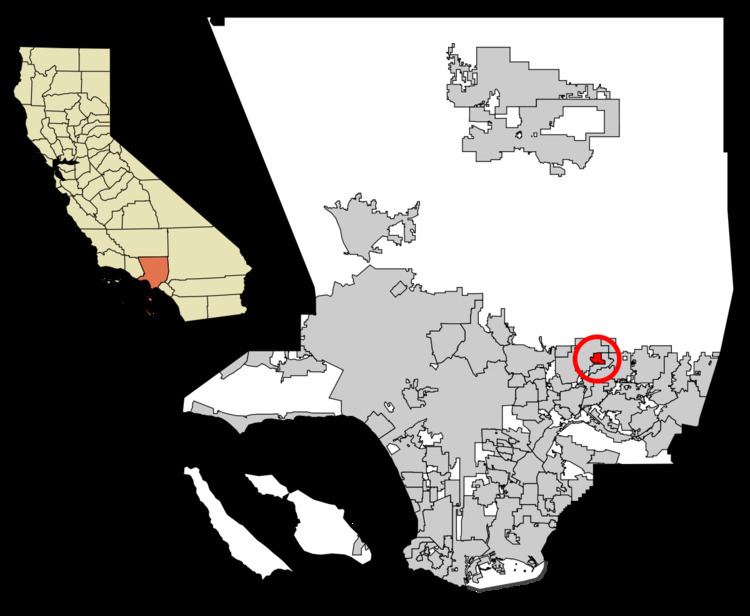
Map of Bradbury, CA 91008, USA
In September 2010, Forbes magazine placed Bradbury's zip code of 91008 at #1 on its annual list of America's most expensive zip codes. Since 2010 Bradbury has fallen on the list but continues to be one of the most expensive zip codes in America with home sales decreasing and market listing prices increasing.
History
Bradbury was founded by Lewis Leonard Bradbury on the homestead of Rancho Azusa de Duarte in 1881. In 1912 the Bradburys' daughter, Minerva, married Isaac Polk and built a grand mansion on the property which they named Chateau Bradbury. After years of annexation attempts by the city of Monrovia, Bradbury incorporated in 1957.
Geography
Bradbury is located at 34°8′58″N 117°58′28″W (34.149306, -117.974319).
According to the United States Census Bureau, the city has a total area of 2.0 square miles (5.2 km2), over 99% of it land.
2010
The 2010 United States Census reported that Bradbury had a population of 1,048. The population density was 535.0 people per square mile (206.6/km²). The racial makeup of Bradbury was 652 (62.2%) White (49.0% Non-Hispanic White), 22 (2.1%) African American, 4 (0.4%) Native American, 276 (26.3%) Asian, 0 (0.0%) Pacific Islander, 59 (5.6%) from other races, and 35 (3.3%) from two or more races. Hispanic or Latino of any race were 218 persons (20.8%).
The Census reported that 1,048 people (100% of the population) lived in households, 0 (0%) lived in non-institutionalized group quarters, and 0 (0%) were institutionalized.
There were 354 households, out of which 92 (26.0%) had children under the age of 18 living in them, 231 (65.3%) were opposite-sex married couples living together, 27 (7.6%) had a female householder with no husband present, 15 (4.2%) had a male householder with no wife present. There were 18 (5.1%) unmarried opposite-sex partnerships, and 2 (0.6%) same-sex married couples or partnerships. 61 households (17.2%) were made up of individuals and 24 (6.8%) had someone living alone who was 65 years of age or older. The average household size was 2.96. There were 273 families (77.1% of all households); the average family size was 3.27.
The population was spread out with 173 people (16.5%) under the age of 18, 84 people (8.0%) aged 18 to 24, 196 people (18.7%) aged 25 to 44, 386 people (36.8%) aged 45 to 64, and 209 people (19.9%) who were 65 years of age or older. The median age was 49.1 years. For every 100 females there were 94.1 males. For every 100 females age 18 and over, there were 89.0 males.
There were 400 housing units at an average density of 204.2 per square mile (78.8/km²), of which 307 (86.7%) were owner-occupied, and 47 (13.3%) were occupied by renters. The homeowner vacancy rate was 1.0%; the rental vacancy rate was 7.8%. 934 people (89.1% of the population) lived in owner-occupied housing units and 114 people (10.9%) lived in rental housing units.
2000
As of the census of 2000, there were 855 people, 284 households, and 239 families residing in the city. The population density was 447.3 inhabitants per square mile (172.8/km²). There were 311 housing units at an average density of 162.7 per square mile (62.9/km²). The racial makeup of the city was 70.53% White, 1.75% Black or African American, 0.23% Native American, 19.53% Asian, 5.61% from other races, and 2.34% from two or more races. 13.92% of the population were Hispanic or Latino of any race.
There were 284 households out of which 33.1% had children under the age of 18 living with them, 69.4% were married couples living together, 8.8% had a female householder with no husband present, and 15.5% were non-families. 12.0% of all households were made up of individuals and 3.9% had someone living alone who was 65 years of age or older. The average household size was 3.01 and the average family size was 3.21.
In the city, the population was spread out with 24.7% under the age of 18, 5.7% from 18 to 24, 25.5% from 25 to 44, 28.8% from 45 to 64, and 15.3% who were 65 years of age or older. The median age was 42 years. For every 100 females there were 90.4 males. For every 100 females age 18 and over, there were 95.2 males.
The median income for a household in the city was $100,454, and the median income for a family was $106,736. Males had a median income of $56,250 versus $40,000 for females. The per capita income for the city was $57,717. None of the families and 2.0% of the population were living below the poverty line, including no under eighteens and none of those over 64.
Education
Bradbury and Duarte are both served by the Duarte Unified School District.
Government
In the California State Legislature, Bradbury is in the 25th Senate District, represented by Democrat Anthony Portantino, and in the 48th Assembly District, represented by Democrat Blanca Rubio.
In the United States House of Representatives, Bradbury is in California's 27th congressional district, represented by Democrat Judy Chu.
Public safety
The Los Angeles County Sheriff's Department (LASD) serves Bradbury through the operation of the Duarte satellite substation as well as the Temple Station in Temple City.
The Los Angeles County Fire Department provides fire protection services, their services assigned to Station 44 in Duarte with backup paramedic assistance from Stations 29 in Baldwin Park and 32 in Azusa, as well as the Monrovia Fire Department.