Girish Mahajan (Editor)

Boyne River (Michigan)

Updated on
Edit
Like
Comment
Share on FacebookTweet on TwitterShare on LinkedInShare on Reddit
Length
  
9 km

Mouth
  
Lake Charlevoix

Basin area
  
163.2 km²

Country
  
United States of America

Boyne River (Michigan) truenorthtroutcomwpcontentuploads201304Boyn

Main source
  
Eastern Charlevoix County, northeast Antrim County, northwest Otsego County

River mouth
  
Lake Charlevoix at Boyne City

Basin size
  
40,320 acres (163.2 km)

Source
  
Charlevoix County, Michigan

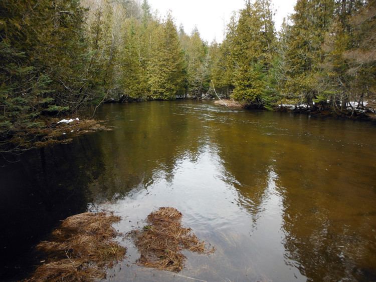
Boyne River is a stream in Northern Michigan, named for the River Boyne in Leinster, Ireland. Together with the north and south branches, the river system has approximately 22 miles (35 km) of mainstream and the water basin drains 40,320 acres (163.2 km2). Boyne River is Lake Charlevoix's second-largest tributary, after the Jordan River.

Contents

Map of Boyne River, Boyne Valley Township, MI, USA

Course

Boyne River's mainstream is approximately 5.6 miles (9.0 km) long, from the confluence of the north and south branches at 45°10′53″N 84°55′12″W less than a mile northwest of the village of Boyne Falls . The main branch flows northwest through Boyne City into Lake Charlevoix at 45°12′53″N 85°00′53″W.

The North Branch Boyne River is 5.9 miles (9.5 km) long and rises in Hudson Township in eastern Charlevoix County at 45°10′34″N 84°48′52″W. The South Branch Boyne River is 10.5 miles (16.9 km) long and rises in Elmira Township in northwest Otsego County at 45°05′10″N 84°48′42″W. The South Branch flows northwest across the northeast corner of Warner Township in Antrim County.

Impoundments

The river system has three major impoundments:

  • The Boyne City Mill Pond within the Boyne City limits less than a mile from the river's mouth. The Boyne City Mill Pond is not a true impoundment resulting from a dam on the river, but affects the river similarly in that itcollects sediments and provides a large surface area that tends to raise the water temperature during the summer months. The pond is called "Little Lake" in a 1901 plat book.
  • The reservoir formed by a hydroelectric dam owned by Boyne Resorts at 45°11′38″N 84°56′53″W. The dam was built about 1906 to provide power to nearby towns. The Boyne River Power Company was consolidated with many other small power providers in west Michigan to form the Michigan Public Service Company in 1927. Consumers Energy bought that company in 1950 and continued to operate the power plant until October 12, 1962, after which the generating equipment was removed and the dam, buildings and land surrounding the reservoir were sold to the Boyne Mountain Lodge in 1963. I n 1982, the Boyne Mountain Resort received a license to operate a 250 kilowatt hydroelectric generator using the existing dam and 80-acre (0.32 km2) reservoir.
  • The Boyne River Pond at 45°10′09″N 84°55′05″W on the South Branch near Boyne Falls. The dam was built before 1900 and the water flow powered a saw mill and grist mill. M-75 crosses the river over the dam.
  • The soils surrounding Boyne River's headwaters are primarily composed of a Kalkaska-Leelanau association (a mixture of Kalkaska and Leelanau sands), and tend to form steep riverbanks. Among the fish species living in Boyne River are chinook salmon, walleye, brook trout, brown trout, and rainbow trout.

    Tributaries

  • (right) Forest Lake, identified as Mud Lake in a 1901 plat book
  • (left) North Branch Boyne River
  • (left) Schoolhouse Creek
  • (right) Cramer Creek
  • (right) Licks Creek
  • (right) Kuznick Creek
  • (right) South Branch Boyne River
  • (right) Moyer Creek
  • Drainage basin

    The Boyne River system drains all or portions of the following cities, townships, and villages:

  • Antrim County
  • Warner Township
  • Charlevoix County
  • Boyne Valley Township
  • Evangeline Township
  • Hudson Township
  • Melrose Township
  • Wilson Township
  • Otsego County
  • Elmira Township
  • Hayes Township
  • References

    Boyne River (Michigan) Wikipedia