Established 1976 (Municipality) Time zone EST (UTC-5) Local time Friday 11:08 AM | Province Ciudad de La Habana Elevation 65 m (213 ft) Area 134 km² | |
 | ||
Wards (Consejos Populares) Altahabana-Capdevila, Armada-Aldabo, Boyeros, Calabazar, Nuevo Santiago, Santiago de Las Vegas, Wajay Weather 26°C, Wind N at 26 km/h, 65% Humidity Points of interest National Botanical Garden, Parque Zoologico Nacional, Monumento El Cacahual | ||
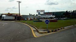
Boyeros (Spanish: oxherds) is one of the 15 municipalities or boroughs (municipios in Spanish) in the city of Havana, Cuba. The municipality was created in 1976, and amalgamated the town of Santiago de Las Vegas. It lies on the south-west side of the city and extends towards the José Martí International Airport.
Contents
Map of Boyeros, Cuba
History
During the 18th, 19th and early part of the 20th century, large waves of Canarian people emigrated to Boyeros.
Demographics
In 2004, the municipality of Boyeros had a population of 188,593. With a total area of 134 km2 (52 sq mi), it has a population density of 1,407.4/km2 (3,645/sq mi). It is divided into seven consejos populares (wards): Santiago de Las Vegas, Nuevo Santiago, Boyeros, Wajay (close to the airport), Calabazar, Altahabana-Capdevila and Armada-Aldabo.
